 OSURIS
environment
GEMET keywords
Type of resources
Available actions
Topics
INSPIRE themes
Keywords
Contact for the resource
Provided by
Years
Formats
Representation types
Update frequencies
status
Scale
-
données de topographie issue de l'ESA - Données COPPERNICUS
-
dunes du nord Mali
-
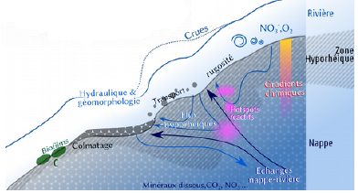
Calcul de la conductivité
-
carte des lacs au nord du Mali
-
Position GPS du réseau de piézomètres du site d'étude de la Flume dans le cadre du projet BERCEAU. Cette ressource indique les coordonnés géographique des piézomètres sous forme de données vectoriel (shape file).
-
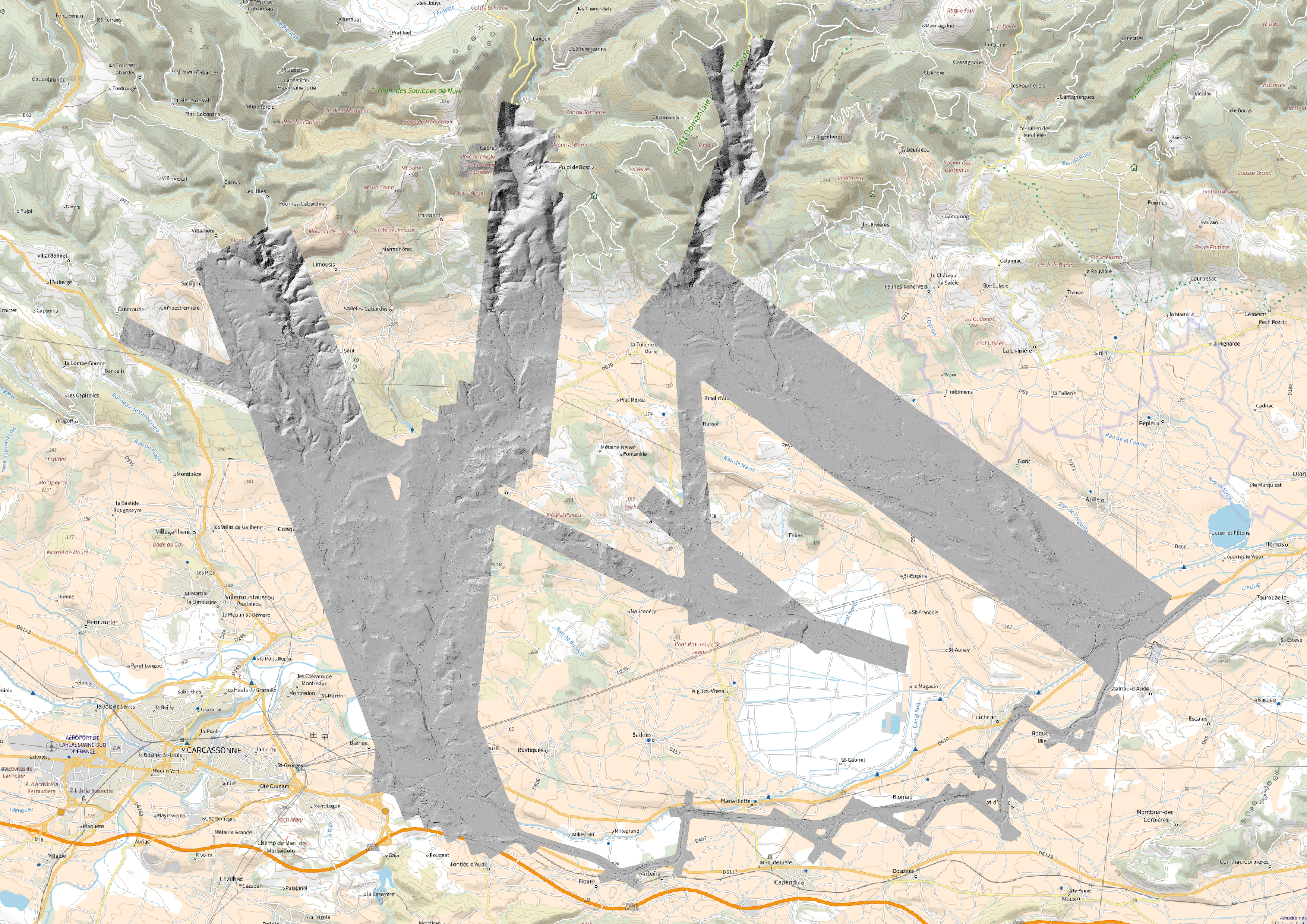
This dataset contains the digital elevation models for the Aude sector as well as the data coverage in the form of a .shp file
-
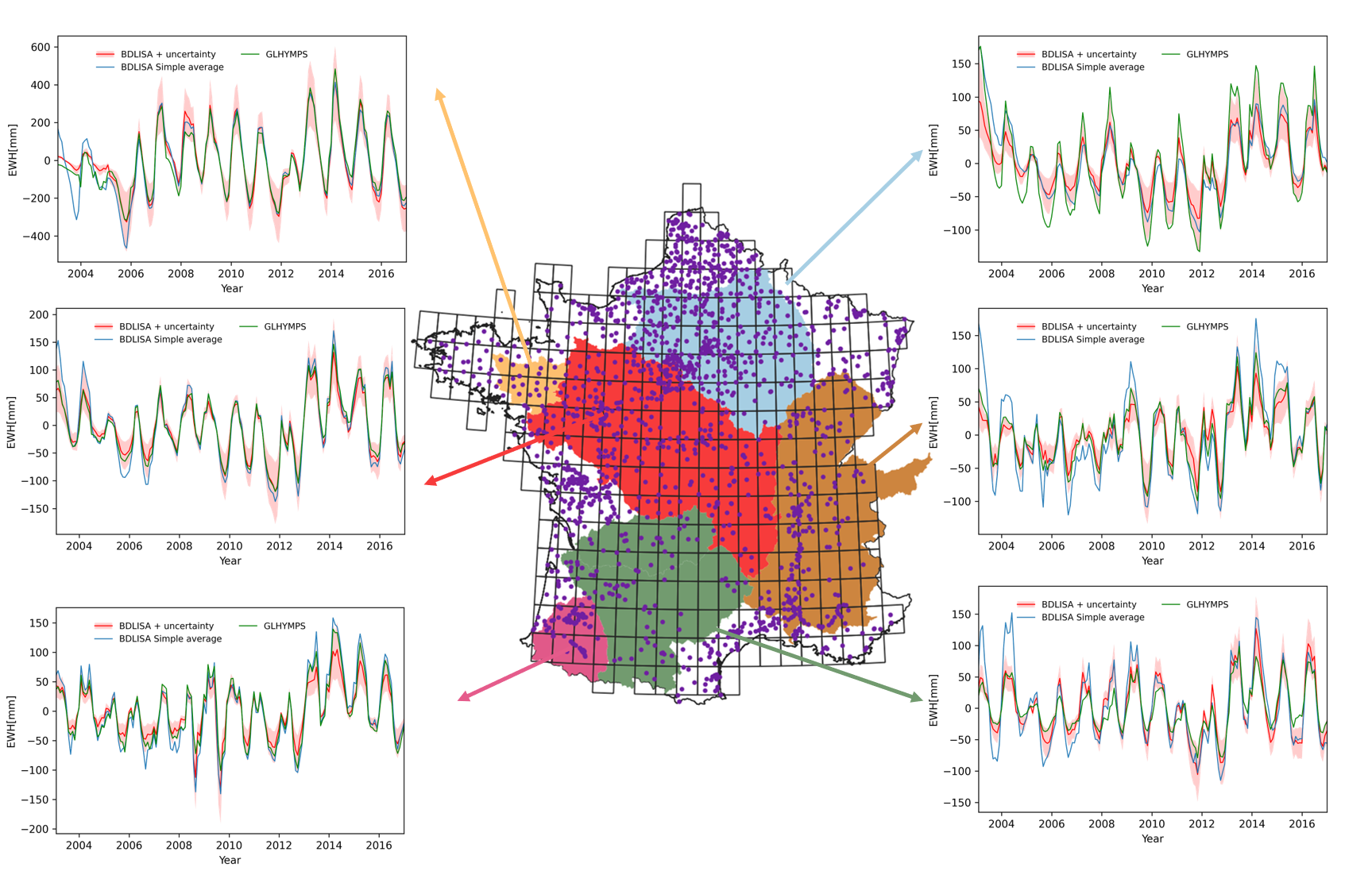
Groundwater comprises approximately 30 percent of the Earth’s total freshwater, serving as a vital resource for both humans and ecosystems. As an essential source of drinking water for humans and sustenance for vegetation, groundwater plays a key role in the terrestrial water cycle. It acts as a buffer, enabling adaptation to climate variability and extreme events like floods and droughts. Therefore, understanding groundwater storage is important for both ecological and15 societal reasons.