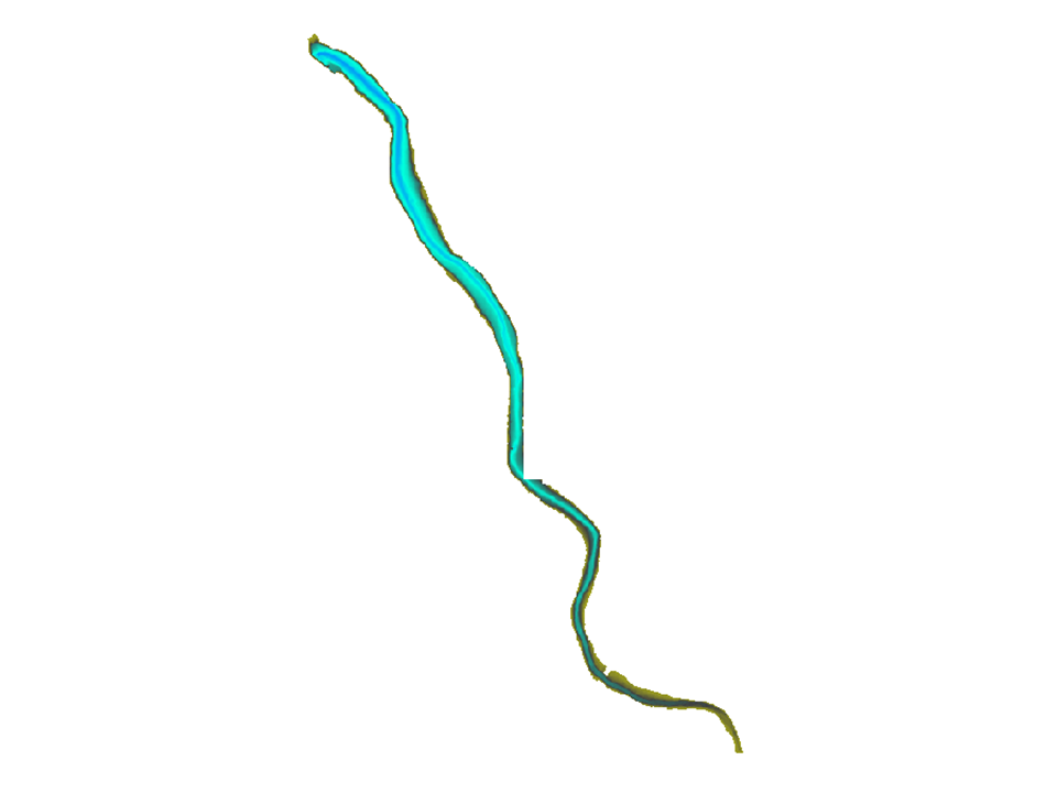
LIDAR bathymetry at La Roche qui Boit (soundings) - Sélune scientific program
The LIDAR bathymetry layer for the Roche qui Boit reservoir shows the bathymetry of the reservoir as measured by EDF using bathymetric LIDAR in 2011.
Simple
- Date (Creation)
- 2015-12-15T16:00:00
- Edition
-
version 1.0
- Identifier
- fr-18007003900276-umrsas-selune-mnt_xyz_rqb3
- Presentation form
- Digital map
- Purpose
-
This layer was created to provide an overview of changes in the reservoir's bathymetry, particularly to visualize the former riverbed and assess the level of silting in the reservoir.
- Status
- Completed
- Maintenance and update frequency
- As needed
- Keywords
-
-
données ouvertes
-
-
GéoBretagne v 2.0
-
-
référentiels : altitude
-
-
UMR SAS Observatoires
-
-
ORE Petits Fleuves Côtiers
-
-
UMR SAS Sites
-
-
Sélune
-
-
UMR SAS Themes
-
-
Altimétrie
-
-
INSPIRE themes
-
-
Altitude
-
- Use limitation
-
Usage libre sous réserve des mentions obligatoires sur tout document de diffusion : "Source : UMR 1069 SAS INRA - Agrocampus Ouest"
- Use limitation
-
Licence ouverte : https://www.etalab.gouv.fr/licence-ouverte-open-licence
- Access constraints
- Other restrictions
- Use constraints
- License
- Other constraints
-
Pas de restriction d’accès public
- Spatial representation type
- Grid
- Denominator
- 1000
- Metadata language
-
fre
- Character set
- UTF8
- Topic category
-
- Boundaries
))
- Reference system identifier
- RGF93 / Lambert-93 (EPSG:2154)
- Distribution format
-
-
GeoTIFF
(
1.0
)
-
GeoTIFF
(
1.0
)
- OnLine resource
- Portail de l information geographique de l UMRSAS ( WWW:LINK-1.0-http--link )
- OnLine resource
-
mnt_xyz_rqb3
(
OGC:WMS
)
Visualiser la couche Bathymétrie LIDAR-retenue de la Roche qui Boit (M.N.T) du Programme Sélune
- OnLine resource
-
Télécharger la couche au format geotiff
(
WWW:DOWNLOAD-1.0-http--download
)
Télécharger la couche au format geotiff
- Hierarchy level
- Dataset
- Statement
-
Cette couche a été créée à partir de données géographiques (X,Y,Z) obtenues à l'aide d'un LIDAR bathymérique lors d'une campagne terrain réalisée par EDF. Le fichier point (X,Y,Z) a ensuite été transformé en RASTER
- File identifier
- 09258fa0-291c-47fd-82c0-604c4f955c4a XML
- Metadata language
-
fre
- Character set
- UTF8
- Hierarchy level
- Dataset
- Date stamp
- 2025-08-13T15:36:06
- Metadata standard name
-
ISO 19115:2003/19139
- Metadata standard version
-
1.0
Overviews

Spatial extent
))
Provided by

 OSURIS