 OSURIS
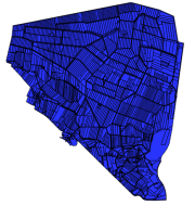
Occupation du sol (Pleine-Fougères, zone D, 1996) - Zone Atelier Armorique ZAAr
Cadre: Carte de l'occupation du site de la zone D de Pleine-fougères (Zone Atelier Armorique) en 1996
Programme: ECCO PNBC
Date du vol: 21/05/1996
Simple
- Date (Création)
- 2008-01-29
- Etat
- Finalisé
- Fréquence de mise à jour
- Non planifiée
-
GEMET
-
-
Informations géoscientifiques
-
ZAAr
-
-
theme.thesaurus_costel.rdf
-
theme.EnvironnementFR.rdf
-
-
Sols
-
Aménagement du territoire
-
Paysages et sites
-
- Limitation d'utilisation
-
Aucune condition ne s’applique
- Contraintes d'accès
- Licence
- Contraintes d'utilisation
- Licence
- Type de représentation spatiale
- Vecteur
- Distance de résolution
- 2.3 m
- Langue
-
fre
- Jeu de caractères
- Utf8
- Catégorie ISO
-
- Carte de référence de la couverture terrestre
- Description
-
France, Fougères, site de Pleine Fougères
N
S
E
W
))
- Nom du système de référence
- EPSG / RGF93 / Lambert-93 (EPSG:2154) / 7.4
- Format (encodage)
-
-
ESRI Shapefile
(
1.0
)
-
ESRI Shapefile
(
1.0
)
- Ressource en ligne
- Osuris ( OGC:WMS )
- Niveau
- Jeu de données
Précision de la position relative
- Description de la méthode d'évaluation
-
Donnée d'occupation du sol issu de la photo-interprétation de clichés aériens IGN à partir du parcelle de la ZAA non conforme IGN (digitalisation à partir du Scan 25)
Résultat quantitatif
- Type de valeur
- measure
- Valeur
- 1,5m
- Identifiant de la fiche
- 85b1e1bc-ae8a-4014-8d09-16148dacf0f7 XML
- Langue
-
fre
- Jeu de caractères
- Utf8
- Identifiant de la fiche de métadonnées parent
-
Collections de couches d'occupation du sol, divers dispositifs de suivi - Zone Atelier Armorique ZAAr
204e507a-27d9-48d7-8b85-2bab34c991d8
- Type de ressource
- Jeu de données
- Nom du niveau de hiérarchie
-
Jeu de données
- Date des métadonnées
- 2026-03-17T11:38:33
- Nom du standard de métadonnées
-
ISO 19115
- Version du standard de métadonnées
-
1.0
Aperçus
thumbnail

large_thumbnail
Étendue spatiale
N
S
E
W
Fourni par

Ressources associées
Not available