OSURIS
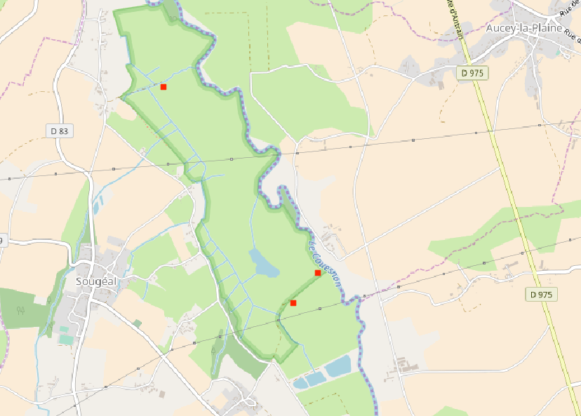
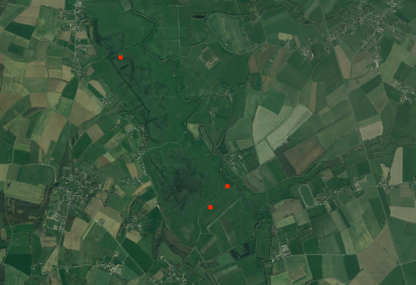
Niveaux Piezometrique (Sougeal, 2017) - Zone Atelier Armorique ZAAr
Niveaux d'eau dans divers compartiments du marais de sougeal.
Mesures automatique horaire, temps UTC, hauteur NGF, température de l'eau à 2m sous le sol
Type de sonde : sonde Divers
Précision :+/- 2 cm et 0.1°c
https://www.vanessen.com/products/water-level/td-diver
Releves trimestriels environ
Simple
- Date (Création)
- 2016-10-26T10:00:00
- Identificateur
- https://www.osuris.fr/geonetwork/srv/metadata/c34f8a48-af6d-49ec-abf2-8fe5d786b68c
- But
-
Corréler niveau d'eau mesurés in-situ et relevés satellitaires et LIDAR
Avoir une meilleurs connaissance de la ressource hydrique du marais
- Etat
- Mise à jour continue
- Fréquence de mise à jour
- Lorsque nécessaire
- Temps
-
-
Nieaux piézométriques
-
Température
-
Niveaux NGF
-
ZAAr
-
- Localisation
-
-
Zone Atelier Armorique ZAAr
-
-
GEMET - INSPIRE themes, version 1.0
-
-
Installations de suivi environnemental
-
- Limitation d'utilisation
-
Usage libre sous réserve des mentions obligatoires sur tout document de diffusion : "Source : {Unité de recherche}""
- Limitation d'utilisation
-
Licence ouverte : https://www.etalab.gouv.fr/licence-ouverte-open-licence
- Contraintes d'accès
- Autres restrictions
- Contraintes d'utilisation
- Licence
- Autres contraintes
-
Pas de restriction d’accès public
- Type de représentation spatiale
- Vecteur
- Dénominateur de l'échelle
- 1
- Langue
- Français
- Jeu de caractères
- Utf8
- Catégorie ISO
-
- Environnement
- Eaux intérieures, Hydrographie
- Climatologie, météorologie, atmosphère
))
- Date de début
- 2016-10-26
- Date de fin
- 2016-10-26
- Nom du système de référence
- EPSG / RGF93 / Lambert-93 (EPSG:2154)
- Format (encodage)
-
-
ESRI Shapefile
(
{version si connue}
)
-
ESRI Shapefile
(
{version si connue}
)
- Ressource en ligne
- piezo_sougeal_DGPS ( OGC:WMS-1.3.0-http-get-map )
- Niveau
- Jeu de données
Résultat de conformité
- Date (Publication)
- 2018-06-29
- Explication
-
{conformité}
- Degré de conformité
- Oui
- Généralités sur la provenance
-
Relevés automatiques par sondes
- Identifiant de la fiche
- c34f8a48-af6d-49ec-abf2-8fe5d786b68c XML
- Langue
- Français
- Jeu de caractères
- Utf8
- Type de ressource
- Jeu de données
- Type de ressource
- Jeu de données
- Date des métadonnées
- 2026-03-17T11:35:04
- Nom du standard de métadonnées
-
ISO 19115:2003/19139
- Version du standard de métadonnées
-
1.0