 OSURIS
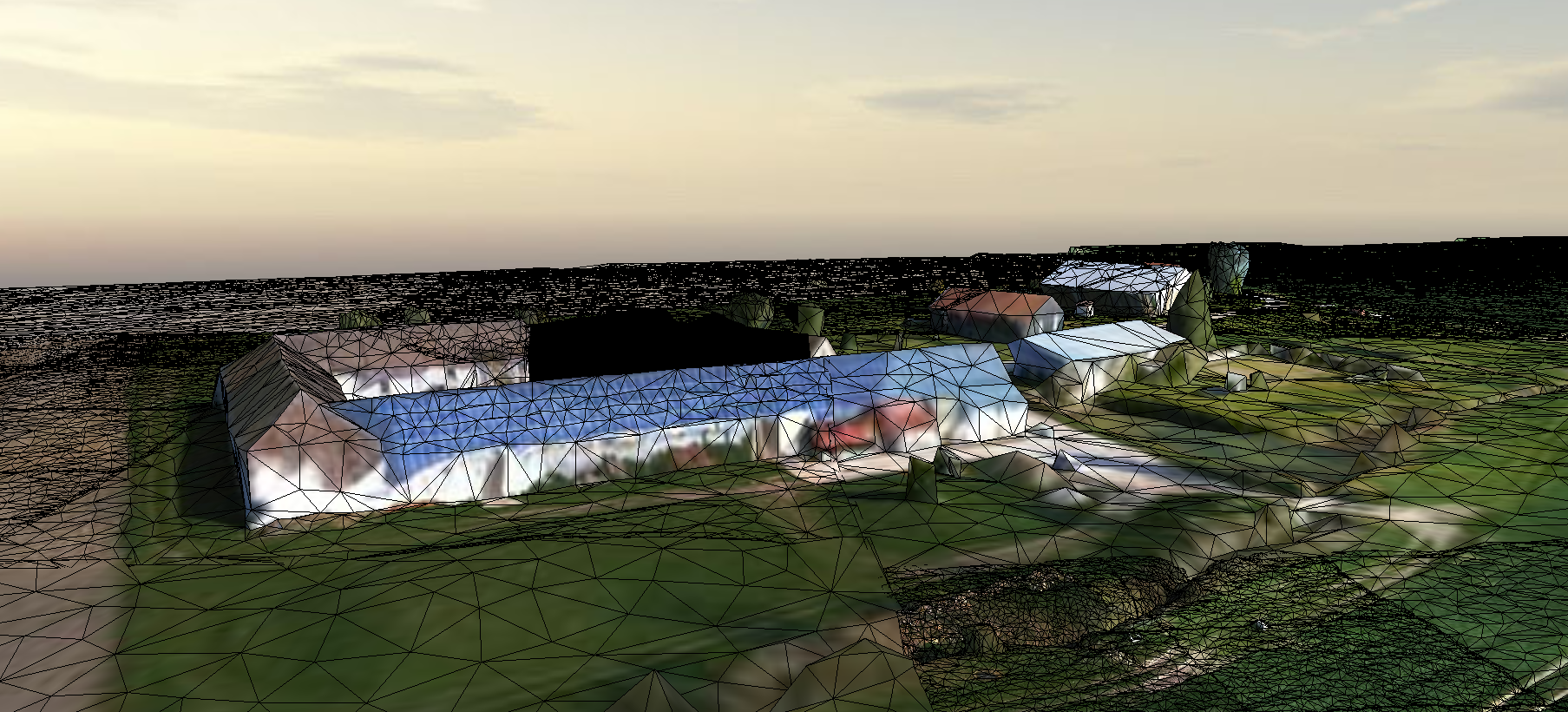
Maquette tridimentionnelle sur le Ru des Effervettes (77) , acquisition par drone le 15/04/2021.
Survol d'une partie du Ru des Effervettes,en limite des communes de Nangis et Fontains, dans le département de la Seine et Marne. Les données ont été acquises par drone anafiet restituées en un maillaige tridimentionnel (mesh).
Simple
- Date (Révision)
- 2022-05-17T19:08:55
- Edition
-
1.0
- Date d'édition
- 2015-01-01
- Identificateur
- c80959ba-c769-4b01-8025-468abd43bc65
- But
-
Utilisation pour un atelier de discussion sur l'aménagement d'une partie du Ru des Effervettes (enjeux pesticides, biodiversité, connectivité) avec les acteurs locaux.
- Etat
- Finalisé
- Fréquence de mise à jour
- Non planifiée
- Limitation d'utilisation
-
This work is licensed under a Creative Commons Attribution 4.0 License (CC BY 4.0, https://creativecommons.org/licenses/by/4.0).
- Contraintes d'accès
- Licence
- Contraintes d'utilisation
- Licence
- Restrictions de manipulation
- Non classifié
- Explications sur les restrictions
-
unclassified
- Système de classification
-
no classification in particular
- Description de manipulation
-
description
- Type de représentation spatiale
- Vecteur
- Langue
- Français
- Jeu de caractères
- Utf8
- Catégorie ISO
-
- Biologie, faune et flore
- Altimétrie
))
- Date de début
- 2021-04-15T00:00:00Z
- Date de fin
- 2021-04-23T00:00:00Z
- Informations supplémentaires
-
some additional information
- Nom du système de référence
- EPSG / 2154
- Format (encodage)
-
-
MXB
(
1.0
)
-
MXB
(
1.0
)
- Ressource en ligne
- Maquette 3D SPIRIT ( file for download )
- Niveau
- Jeu de données
Résultat de conformité
- Autres appellations ou acronymes
-
This is is some data quality check report
- Date (Publication)
- 2022-05-17T19:08:55
- Explication
-
some explanation about the conformance
- Degré de conformité
- Oui
Résultat de conformité
- Date (Publication)
- 2010-12-08T12:00:00
- Explication
-
See the referenced specification
- Degré de conformité
- Oui
Résultat de conformité
- Date (Publication)
- 2008-12-04T12:00:00
- Explication
-
See the referenced specification
- Degré de conformité
- Oui
- Généralités sur la provenance
-
Données acquises par drone anafi (parrot) et traitées par photogrammétrie par le logiciel ContextCapture (Bentley) .
- Identifiant de la fiche
- c80959ba-c769-4b01-8025-468abd43bc65 XML
- Langue
- Français
- Jeu de caractères
- Utf8
- Type de ressource
- Jeu de données
- Date des métadonnées
- 2022-05-17T19:26:59
- Nom du standard de métadonnées
-
ISO 19115:2003/19139
- Version du standard de métadonnées
-
1.0
Aperçus
Étendue spatiale
Fourni par
