 OSURIS
Keyword
Zone humide potentielle
Type of resources
Available actions
Topics
INSPIRE themes
Keywords
Contact for the resource
Provided by
Formats
Representation types
Update frequencies
status
Scale
From
1
-
1
/
1
-
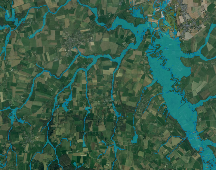
This map represents potential wetlands of the Couesnon watershed bottom valley at 1 : 25 000. Potential wetlands correspond to the largest area that wetlands would represent without human activity and are characterized by a hydromorphic soil (Mérot et al., 2006). A LiDAR-derived DTM (from IGN) and 107 soil samples were used to estimate an elevation threshold between hydromorphic and non-hydromorphic soil, according to the nearest stream Strahler order (Rapinel et al, 2017).