 OSURIS
environment
GEMET keywords
Type of resources
Available actions
Topics
INSPIRE themes
Keywords
Contact for the resource
Provided by
Years
Formats
Representation types
Update frequencies
status
Scale
Resolution
-
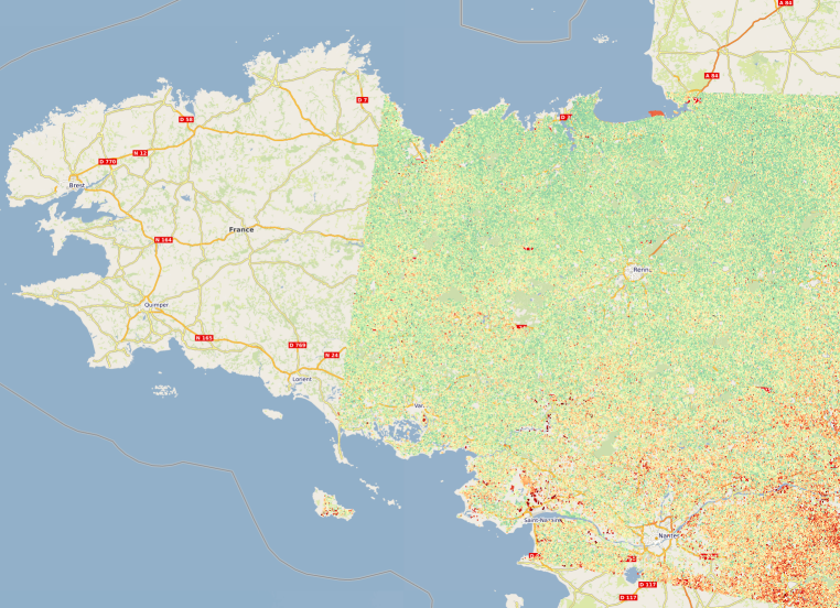
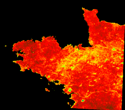
Estimation de l'humidité des sols de Bretagne représentée sous la forme d'une série temporelle d'images raster à 10 mètres de résolution entre janvier 2017 et décembre 2022. La méthode d’estimation de l’humidité, développée à l’INRAE (UMR TETIS), est basée sur l'utilisation d'images satellitaires des nouveaux systèmes d’observation de la Terre Copernicus radar et optique Sentinel-1 et Sentinel-2. Plus d'informations sur la méthode : https://geosas.fr/metadata/pdf/Livrable_TED_Bosco_Mars2022_Bretagne_INRAE_Baghdadi.pdf
-
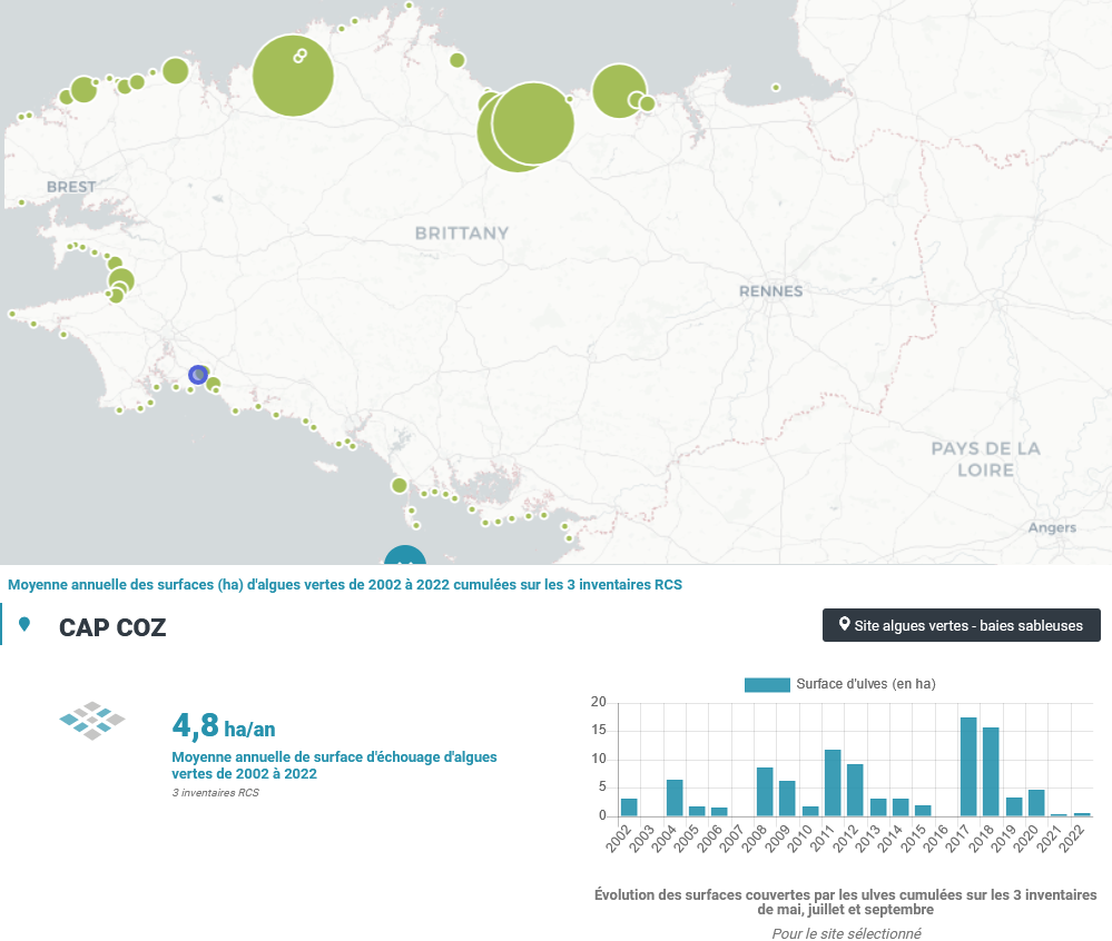
Le CEVA a été chargé, de 2002 à 2006, de la mise en place puis de la réalisation du suivi du phénomène de « marées vertes » à l’échelle de la Bretagne, dans le cadre du programme Prolittoral, programme régional et interdépartemental de lutte contre les marées vertes (financement de l’Agence de l’Eau Loire Bretagne, du Conseil régional de Bretagne et des quatre Conseils généraux bretons). Dans ce cadre, le CEVA a développé des outils spécifiques pour évaluer le phénomène et son évolution. Ces outils ont été élaborés en partant de la connaissance du phénomène acquise au travers des suivis antérieurs, réalisés pour le compte du Conseil général des Côtes d’Armor, de l’Agence de l’Eau Loire Bretagne et de collectivités locales bretonnes particulièrement touchées par le phénomène. Depuis 2007, le CEVA réalise les inventaires de marées vertes du Réseau de Contrôle de Surveillance (RCS) dans le cadre de la Directive Cadre sur l’Eau (DCE) pour l’évaluation des masses d’eau côtières et de transition, financée par l’Agence de l’Eau Loire Bretagne. Trois survols sont réalisés chaque année (mai, juillet, septembre) de l’ensemble du littoral (du Mont Saint Michel à l’île de Ré) faisant l’objet de l’acquisition de photographies aériennes à partir desquelles des surfaces d’échouages d’ulves sont mesurées. Pour les sites de type « sableux » classés « site à échouage d’ulves », l’estimation surfacique des échouages d’ulves en lame est réalisée pour chaque inventaire. Pour les sites de type « vaseux » marqués par un tapis continu d’algues vertes, toutes les surfaces couvertes par les algues vertes (filamenteuses ou en lames) sont estimées uniquement pour l’inventaire présentant un maximal annuel de biomasse. Cela fait suite à la mise au point des grilles de classement européennes de la DCE des masses d’eau de type « abritées » (vasières) en 2008.
-
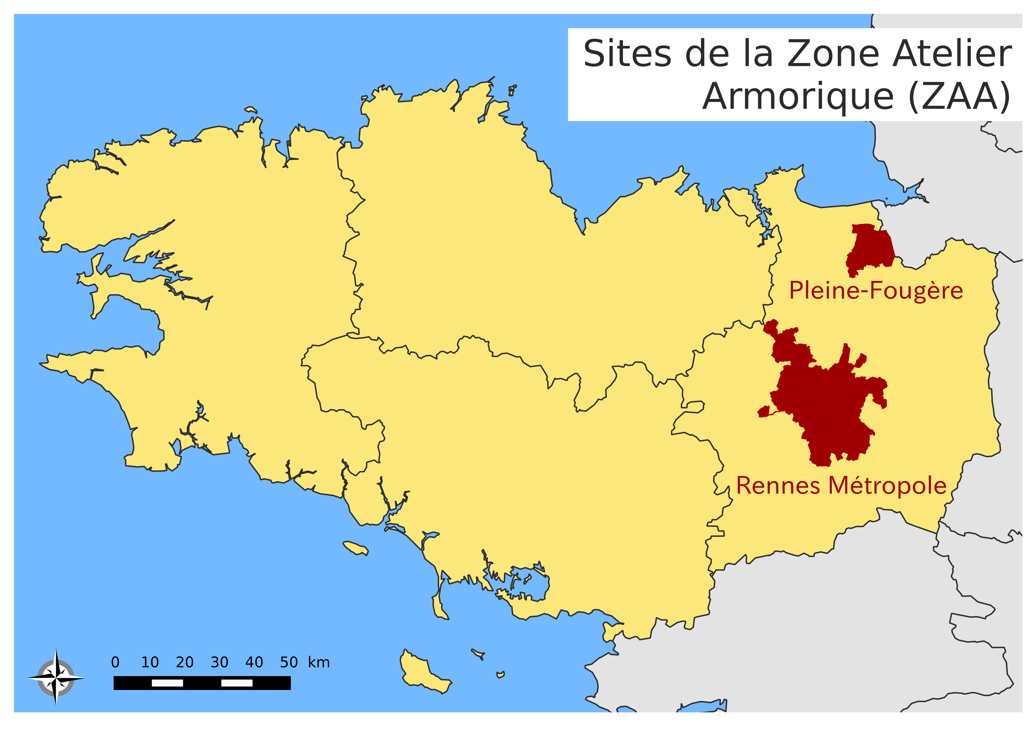
Le site urbain de la Zone Atelier Armorique ZAAr (parfois désigné par "Site de Rennes-Métropole"). Les types de paysages sont des systèmes urbains, des systèmes bocagers plus ou moins dégradés et des systèmes de zones humides.
-
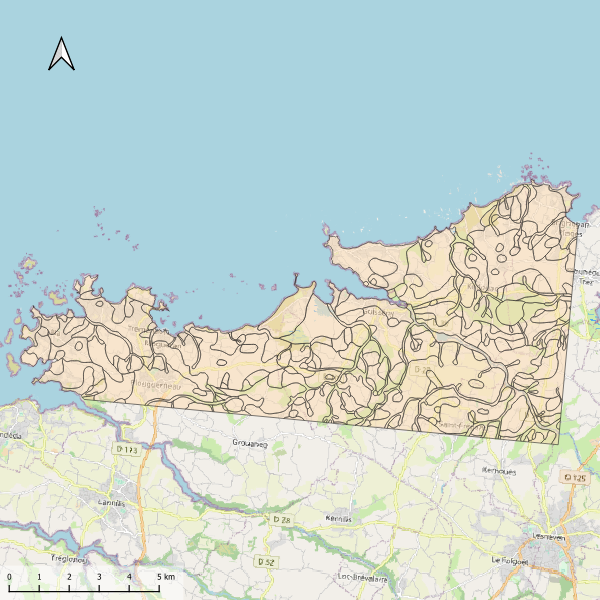
Carte pédologique de Plouguerneau au 1/50000. La codification correspond au code 4 critères des sols du Massif armoricain (voir ressources en ligne). Les champs de la table attributaire sont : - SUB : Matériau(x) parental(aux) à partir du(des)quel(s) se développe(nt) le sol - HYD : Classe d'hydromorphie, de 0 (sol bien drainé) à 9 (sol extrêmement hydromorphie) - TYPE : Développement de profil défini à partir de la succession des horizons - PROF : Profondeur du sol, classée de 1 (sols très épais) à 6 (sols superficiels) - CODE4C : code 4 critères issu de la concaténation des champs précédents. Les valeurs prises par les différents champs pour chaque entité sont détaillées dans la méthode 4 critères (voir ressources en ligne). - UTS : Numéro d'Unité Typologique de Sol issue du Référentiel Régional Pédologique de Bretagne.
-
L'Evaporative Fraction (EF) est un indice permettant d'avoir une connaissance relative des zones à fort potentiel hydrique, et inversement, par l'estimation de la capacité d'un sol à évaporer. Cette capacité s'estime via des valeurs allant de 0 (non évaporante) à 1.26 (très évaporante).
-
Carte pédologique de Pipriac au 1/25000. La codification correspond au code 4 critères des sols du Massif armoricain (voir ressources en ligne). Les champs de la table attributaire sont : - SUB : Matériau(x) parental(aux) à partir du(des)quel(s) se développe(nt) le sol - HYD : Classe d'hydromorphie, de 0 (sol bien drainé) à 9 (sol extrêmement hydromorphie) - TYPE : Développement de profil défini à partir de la succession des horizons - PROF : Profondeur du sol, classée de 1 (sols très épais) à 6 (sols superficiels) - CODE4C : code 4 critères issu de la concaténation des champs précédents. Les valeurs prises par les différents champs pour chaque entité sont détaillées dans la méthode 4 critères (voir ressources en ligne). - UTS : Numéro d'Unité Typologique de Sol issue du Référentiel Régional Pédologique de Bretagne.
-
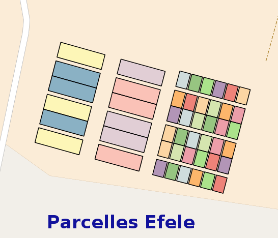
La couche des parcelles du Système d’Observatoires d’Expérimentations et de Recherche en Environnement (SOERE) de Produits Résiduaires Organiques (PRO) EFELE représente la position géographique des parcelles ou sont effectuées différentes mesures de l'air, du sol et de l'eau.
-
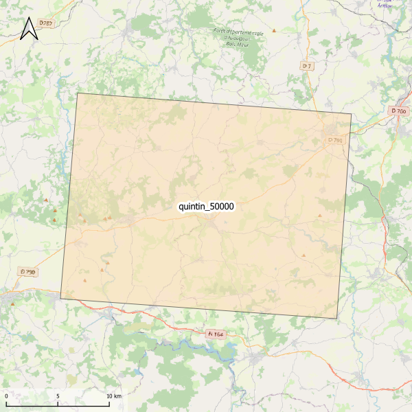
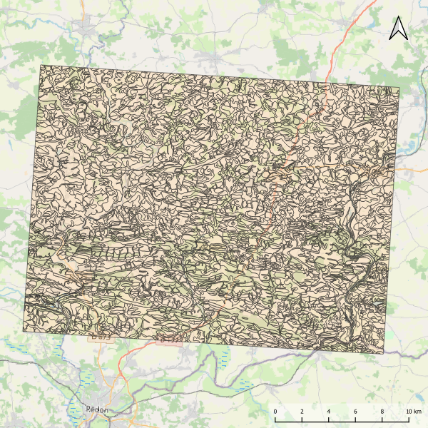
Emprise de la carte pédologique de Quintin au 1/50000. La donnée de base, au format vectoriel, n'est pas publiée.
-
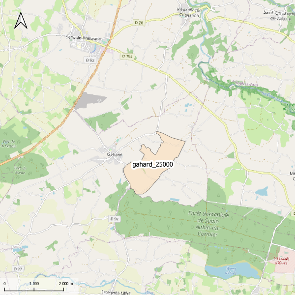
Emprise de la carte pédologique de Gahard au 1/25000. La donnée de base, au format image scannée, n'est pas publiée.
-
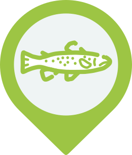
L’ouverture des barrages va considérablement impacter le fonctionnement des populations de truites de la Sélune. Le rétablissement de la continuité écologique du fleuve modifiera les flux populationnels en autorisant la remontée plus en amont des truites de mer amphihalines et le déplacement des truites autochtones en aval et en amont des barrages. La population de truites est suivie sur un réseau de stations couvrant l’ensemble du bassin de la Sélune à l'aide d'un indice d’abondance, qui est effectué tous les 2 ans. Les campagnes de terrain respectent le protocole de pêche Vigitruite®, mis au point à l’INRAE et destiné à être utilisé partout en France. Cet indice d’abondance, rapporté à la superficie d’habitats favorables sur le cours d’eau permet d’évaluer la quantité de truitelles présentes dans la rivière, issues de la reproduction naturelle des années passées. Les campagnes de terrain sont assurées par INRAE et la Fédération d'Ille-et-Vilaine pour la Pêche et la Protection du Milieu Aquatique (FDAAPPMA35) Cette couche donne les localisations de ces secteurs d'étude selon l'année d'étude : 2012, 2014, 2018, 2020, 2022, 2023, 2024 et 2025.