 OSURIS
Couesnon
Type of resources
Available actions
Topics
INSPIRE themes
Keywords
Contact for the resource
Provided by
Formats
Representation types
Update frequencies
status
Scale
-
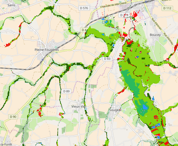
Vegetation classification of potential wetlands of the Couesnon watershed in 9 EUNIS classes. Classification was made from Sentinel-1 and Sentinel-2 time-series of 2016-2017 vegetation cycle and 355 plot samples (90 from field and 265 from visual observation of Sentinel-2 color composite or Google Earth imagery) splited into the 9 classes. Random forest classification was applied on R. Classes description and EUNIS code associated 1 : Constructed, industrial and other artificial habitats J 2 : Intensive unmixed crops I1.1 3 : Inland surface water C 4 : Mixed riparian floodplain and gallery woodland G1.2 5 : Atlantic and sub-Atlantic humid meadows E3.41 6 : Species-rich helophyte beds C3.1 7 : Coastal saltmarshes and saline reedbeds A2.5 8 : Water-fringing reedbeds and tall helophytes other than canes C3.2 9 : Raised bogs D1.1
-
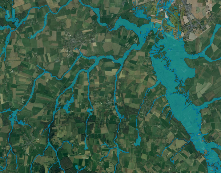
This map represents potential wetlands of the Couesnon watershed bottom valley at 1 : 25 000. Potential wetlands correspond to the largest area that wetlands would represent without human activity and are characterized by a hydromorphic soil (Mérot et al., 2006). A LiDAR-derived DTM (from IGN) and 107 soil samples were used to estimate an elevation threshold between hydromorphic and non-hydromorphic soil, according to the nearest stream Strahler order (Rapinel et al, 2017).