 OSURIS

GEMET keywords
Type of resources
Available actions
Topics
INSPIRE themes
Keywords
Contact for the resource
Provided by
Years
Formats
Representation types
Update frequencies
status
Scale
Resolution
-
Quantification de la connectivité paysagère par test de repasse sur les passereaux communs de la métropole rennaise. Identification des espèces et réponse à la repasse de chant territorial. Dans le cadre de la thèse de Manon Balbi, projet Corbam.
-

Relevés ponctuels d'humidité des sols (-3 cm) effectués à l'aide d'un capteur TDR sur 4 transects des bas marais du Couesnon. Recherche effectuée dans le cadre des programmes Zone Atelier et SOAR.
-
Étude sur les zones humides de la "Baie du Mont Saint Michel". Cartographie linéaire des résaux hydrographiques. Site Étudié : Marais d'Aucey-Boucey. Objectif : -Diagnostics phyto-écologique et paysager des marais de la basse vallée du Couesnon et de leur rôle fonctionnel potentiel en terme d'accueil de l'avifaune. -Proposer des orientations de gestion. -Optimiser les conditions d'accueil pour l'avifaune, par une gestion intégrée des activités humaines sur les sites concernés. -Identifier les enjeux de conservation.
-

Objectif : Ce suivi a pour objectif d'analyser la dynamique végétale après semis des bandes enherbées expérimentales. Le semis a été réalisé en 2010 Sur les BE, les relevés floristiques ont été effectués en juin 2010, 3 mois après semis. Les quadrats utilisés sont de 2x2 m, positionnés à 3m du bord de la bande enherbée selon 10 points dans le sens de la longueur. Le pourcentage de recouvrement par rapport au sol des différentes espèces en présence a été évalué à l'estime avec une précision de 5%. Projet : ANR MODECOL Programme de recherche : Système Complexe et Modèlisation de l'ANR Coordinatrice : Cendrine Mony
-
"Diversité gamma des carabes (Nord Ille et Vilaine, 2011) Zone Atelier Armorique ZAAr" Caractérisation de la diversité gamma des carabes du Nord de l’Ille et Vilaine (2011) Effet de l’hétérogénéité paysagère sur la diversité gamma : le cas des carabes. 20 mailles paysagères ont été choisies. Pour chaque maille : 5 habitats échantillonnés : les bois, les prairies permanentes, les prairies temporaires, les cultures et les haies. Pour mesurer la diversité gamma, 2 réplicats de chaque habitat ont été choisis : 10 relevés par maille.Plusieurs sessions de piégeage ont eu lieu entre mai et septembre 2011. Protocole : 2 pièges Barber par point d’échantillonnage, 4 périodes d’échantillonnage pour les céréales d’hiver, 6 périodes d’échantillonnage pour les autres types d’habitat. Les périodes d’échantillonnage correspondent à une ouverture des pièges pendant 1 semaine. Les relevés ont été réalisés entre Mai et Septembre 2011 Programme : Agriconnect (programme DIVA du ministère de l'environnement) Article de réf : Duflot R, Georges R, Ernoult A, Aviron S, Burel F. (2014) Landscape heterogeneity as an ecological filter of species traits. Acta Oecologica, 56: 19-26.
-
Objectif : Cette tâche vise à étudier la dynamique de la végétation après exclusion de la pression de pâturage. Un exclos au sein de chaque communauté a été mis en place en 2007 pour les communautés mésophile, mésohygrophile et hygrophile et en 2011 dan la prairie à glycérie. Un exclos sera également mis en place en 2011 dans le prolongement de la rosière du secteur Nord pour permettre une extension de sa surface. Programme de recherche : Convention d'étude avec la communauté des communes de la baie du Mont St-Michel Coordinatrice : Cendrine Mony
-
"Données d'enquêtes AGRIM DIVAG (sud Ille et Vilaine, 2019) - Zone Atelier Armorique ZAAr" Recueil d’informations par des enquêtes réalisées auprès des agriculteurs sur les pratiques mis en place sur les parcelles étudiées AGRIM et DIVAG. Les informations collectées concernent : les caractéristiques générales de l’exploitation, l’assolement de l’année considérée, le cheptel de l’exploitation, les caractéristiques du matériel utilisée pour les cultures, les caractéristiques de la parcelle (surface, pente, type de sol, les éléments de bordure de la parcelle), le travail du sol, le semis, les apports en fertilisation minérale et organique, les pesticides utilisés, la récolte. Ce recueil a été réalisé entre décembre 2019 et février 2020. Toutes les données ont été saisies dans Agrosyst. Un formulaire de consentement (relatif à l'exploitation de données RGPD) a été signé par l'ensemble des agriculteurs concernés. Ce travail s’inscrit dans le projet DIVAG (2019) financé par la Zone Atelier Armorique porté par Stéphanie Aviron ainsi que dans le projet AGRIM (2019-2021) financé par l’AFB et porté par Philippe Vanderkoornhuyse et Cendrine Mony.
-
Assemblage de photographie aérienne sur la Zone Atelier Armorique (ZAA) en 2009
-
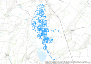
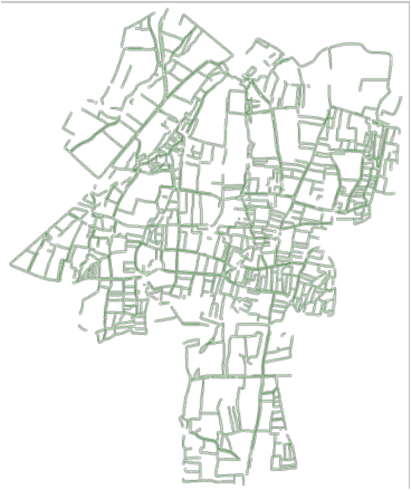
Réseau de haies du site C de Pleine-Fougères en 1996 (Zone Atelier Armorique) réalisée à partir de la photointerprétation de vol IGN (chaque ligne correspond à une haie arborée)
-
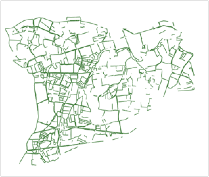
Réseau de haies du site B de Pleine-Fougères en 1996 (Zone Atelier Armorique) réalisée à partir de la photointerprétation de vol IGN (chaque ligne correspond à une haie arborée)