Environnement
GEMET keywords
Type of resources
Available actions
Topics
INSPIRE themes
Keywords
Contact for the resource
Provided by
Years
Formats
Representation types
Update frequencies
status
Scale
Resolution
-

Macrophytes are a group of aquatic plants. They are at the base of the food chain and can provide a habitat for many other species. The relative abundance of different species is used to calculate an environmental quality index (IBMR). As part of the Sélune observatory, pilot stations have been set up along the main course of the Sélune, distributed from upstream to downstream of the hydroelectric dams. Three stations are located in the former reservoirs of the dams, while the other two, known as reference stations, are outside the area of influence of the former dams (one downstream, the other upstream). At these stations, aquatic biocenoses (including benthic macroinvertebrates, biofilms, macrophytes, etc.) are monitored. The parameters monitored are specific composition and cover, at 8 stations in the main course, located upstream, downstream and in neolotic areas of macrophyte communities. The monitoring frequency consists of one annual campaign for stations outside reservoirs (S0, S1 and S5) and two annual campaigns (spring/autumn) for neolotic stations (S2, S3.4, S4.1 and S6). The protocol used is the sampling protocol for macrophytes and bryophytes in accordance with standard NF T90-395 (October 2003), which defines the IBMR. Taxa are sampled for laboratory identification. This layer gives the value of the IBMR and EQR (normalized) index at a station for a campaign, as well as information concerning the robustness of this index, the quantities of taxa used to calculate these indices and also information in terms of the proportion of major floristic groups (heterotrophs, algae, bryophytes, pteridophytes, helophytes, phanerogrames, floating vegetation and submerged vegetation).
-
Microbial communities play a major role in the functioning of ecosystems: they are at the base of the food chain (primary production) and participate in the degradation of organic matter. These communities are also known to respond rapidly to environmental changes. Like macro-invertebrates, they can be used as ecological indicators. Benthic diatoms are the main photosynthetic organisms in this biological community. The relative abundance of the different species is used to calculate an environmental quality index (EQI). Major differences in communities between the upstream and downstream zones were observed when the dams were in place. These differences will change once the dams are removed. As part of the Sélune observatory, pilot stations have been set up along the main course of the Sélune, distributed from upstream to downstream of the hydroelectric dams. Three stations are located in the former reservoirs of the dams, while the other two, known as the reference stations, are outside the area of influence of the former dams (one downstream and the other upstream). At these stations, aquatic biocenoses (including benthic macroinvertebrates, biofilms, macrophytes, etc.) are monitored. Since September 2014, the stations are ideally sampled every month from April to October (7 annual surveys) using artificial substrates (glass slides placed in the water). In addition to the diatom survey (floristic list, IBD calculation), the chlorophyll-a concentration is measured. During each campaign, an INRAe experimental sampling protocol is implemented. This protocol involves the immersion (1 month) of glass slides, an in situ measurement of the chlorophyll-a concentration via BentoTorch and then the collection of the biofilm on these glass slides. The biofilm is conditioned in (1) 99.9% ethanol to determine IBDs and floristic lists (outsourced service, based on standard NF T90-354) and (2) mineral water to measure chlorophyll-a concentration using a spectrometer. NB: the year 2023 is not covered in terms of measuring chlorophyll-a concentration via spectrometry due to a problem with the low-temperature storage of samples. This dataset provides measurements of the average daily concentration of chlorophyll-a and pheopigment in µg/cm2/day.
-
Microbial communities play a major role in the functioning of ecosystems: they are at the base of the food chain (primary production) and participate in the degradation of organic matter. These communities are also known to respond rapidly to environmental changes. Like macro-invertebrates, they can be used as ecological indicators. Benthic diatoms are the main photosynthetic organisms in this biological community. The relative abundance of the different species is used to calculate an environmental quality index (EQI). Major differences in communities between the upstream and downstream zones were observed when the dams were in place. These differences will change once the dams are removed. As part of the Sélune observatory, pilot stations have been set up along the main course of the Sélune, distributed from upstream to downstream of the hydroelectric dams. Three stations are located in the former reservoirs of the dams, while the other two, known as the reference stations, are outside the area of influence of the former dams (one downstream and the other upstream). At these stations, aquatic biocenoses (including benthic macroinvertebrates, biofilms, macrophytes, etc.) are monitored. Since September 2014, the stations are ideally sampled every month from April to October (7 annual surveys) using artificial substrates (glass slides placed in the water). In addition to the diatom survey (floristic list, IBD calculation), the chlorophyll-a concentration is measured. During each campaign, an INRAe experimental sampling protocol is implemented. This protocol involves the immersion (1 month) of glass slides, in situ measurement of chlorophyll-a concentration via BentoTorch and then collection of the biofilm on these glass slides. The biofilm is conditioned in (1) 99.9% ethanol for determination of IBDs and floristic lists (outsourced service, based on standard NF T90-354) and (2) mineral water for measurement of chlorophyll-a concentration using a spectrometer. Taxon identification is based on version v17 of the TAXREF reference. The dataset is currently under embargo.
-
Macrophytes are a group of aquatic plants. They are at the base of the food chain and can provide a habitat for many other species. The relative abundance of different species is used to calculate an environmental quality index (IBMR). As part of the Sélune observatory, pilot stations have been set up along the main course of the Sélune, distributed from upstream to downstream of the hydroelectric dams. Three stations are located in the former reservoirs of the dams, while the other two, known as reference stations, are outside the area of influence of the former dams (one downstream, the other upstream). At these stations, aquatic biocenoses (including benthic macroinvertebrates, biofilms, macrophytes, etc.) are monitored. The parameters monitored are specific composition and cover, at 8 stations in the main course, located upstream, downstream and in neolotic areas of macrophyte communities. The monitoring frequency consists of one annual campaign for stations outside reservoirs (S0, S1 and S5) and two annual campaigns (spring/autumn) for neolotic stations (S2, S3.4, S4.1 and S6). The protocol used is the sampling protocol for macrophytes and bryophytes in accordance with standard NF T90-395 (October 2003), which defines the IBMR. Taxa are sampled for laboratory identification. This layer gives Taxon identification is based on version v17 of the TAXREF reference. The dataset is currently under embargo.
-
Microbial communities play a major role in the functioning of ecosystems: they are at the base of the food chain (primary production) and participate in the degradation of organic matter. These communities are also known to respond rapidly to environmental changes. Like macro-invertebrates, they can be used as ecological indicators. Benthic diatoms are the main photosynthetic organisms in this biological community. The relative abundance of the various species is used to calculate an environmental quality index (EQI). Major differences in communities between the upstream and downstream zones were observed when the dams were in place. These differences will change once the dams are removed. As part of the Sélune Observatory, the stations are sampled every month from April to October (7 annual surveys) using artificial substrates (glass slides placed in the water). In addition to the diatom survey (floristic list, IBD calculation), the chlorophyll a concentration is measured. This layer gives the IBD and EQR (normalised) index value for a station during a campaign.
-
As part of the Biomonitoring project and the Sélune observatory , pilot stations have been set up along the main course of the Sélune, distributed from upstream to downstream of the hydroelectric dams. Three stations are located in the former reservoirs of the dams, while the other two, known as the reference stations, are outside the area of influence of the former dams (one downstream and the other upstream). At these stations, aquatic biocenoses (including benthic macroinvertebrates, biofilms, macrophytes, etc.) are monitored. 2 sampling campaigns (spring and autumn) for benthic macroinvertebrates (bmi) have been carried out since September 2014. During each campaign, 2 sampling protocols are implemented: - in accordance with standard NF T90-333, which enables the calculation of the IBG-DCE and I2M2 (‘SURBER’) - via artificial substrates immersed for 1 month (‘SUBART’), in order to focus on measuring the ‘effect of dams’. The protocol is described in: Piscart C., Moreteau, J.C., Beisel J.N. (2006). Monitoring changes in freshwater macroinvertebrate communities along a salinity gradient using artificial substrates. Environmental Monitoring and Assessment 116: 529-542. This layer details the benthic macroinvertebrate taxa and their abundance obtained after analysis (according to standard NF T90-388). These data are distributed by campaign and by sector. Taxa presenting all the morphological criteria clearly visible and characteristic allowing the exactitude of their determination and an irreproachable state of conservation are integrated into the reference collection of the Sélune Observatory. This collection can be consulted on request (see contact point). Taxon determination is based on version v17 of the TAXREF reference. The dataset is currently under embargo.
-
La zone d'étude se situe au nord ouest du Sénégal et s'étale sur 5 100km². Elle inclue la ville de Thiès et une partie de la ville de Dakar, et remonte jusqu'à Kébémer, aux portes du désert de Loumpoul. La carte d'occupation 2018 a été réalisée à partir d'une image à Très Haute Résolution Spatiale (THRS) à 1.5m Spot6 acquise le 15/10/2010 et une série temporelle d'images Sentinel2 (résolution 10m) acquises entre le 01/01/2018 et le 31/12/2018. Le traitement a été réalisé via la chaine de traitement Moringa développée dans l'UMR TETIS. La méthodologie s'appuie sur une Segmentation Orientée Objet de l'image THRS puis d'une classification de chaque polygone (algorithme Random Forest) s'appuyant sur l'image SPOT6, la série temporelle Sentinel2, le SRTM à 30m et de nombreux indices calculés à partir de ces images (NDVI, indices de texture, pente,...). L’algorithme a été entrainé via un jeu de données acquises sur le terrain complété de données obtenues par photo-interprétation. Des corrections manuelles par photo-interprétation ont été réalisées afin d'améliorer le résultat. La précision globale est de 93%. La classification contient 13 classes d'occupation du sol : culture irriguée hors bas-fond, culture irriguée de bas-fond, culture pluviale, plantation, dune sable - arbustes, eau, savane arbustive, savane herbacée, sol nu, sol inondable, sol faiblement végétalisé, végétation naturelle dense et zone urbaine.
-
Les flux hydrologiques, sédimentaires fins et grossiers, et chimiques sont fortement impactés par la présence des barrages, alors que ces paramètres jouent un rôle majeur sur la qualité des habitats pour les communautés aquatiques. leur suivi sur le long terme est primordial dans le cadre d’une opération de restauration écologique après effacement de barrages. De plus sur la Sélune, le démantèlement s’accompagne d’une gestion spécifique des sédiments pour éviter un transfert massif de sédiments vers l’aval. Le transport des sédiments grossiers est étudié à l’aide de galets marqués par des transpondeurs passifs (pit tags). Ces pit tags ont été introduits dans plusieurs centaines de galets de différentes tailles du fleuve. Leurs déplacements au cours du cycle hydrologique sont suivis à l’aide d’une antenne que l’on déplace manuellement en parcourant la rivière, à raison d’une campagne par an. Cette couche donne les localisations des secteurs d'étude utilisés dans le suivi du transport des sédiments grossiers.
-
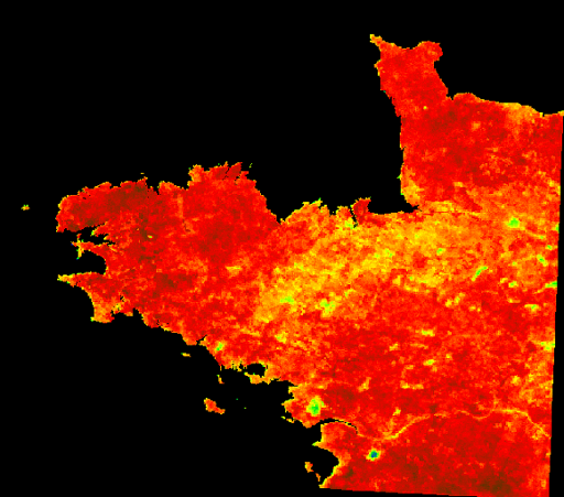
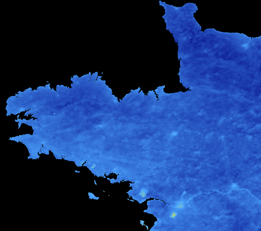
Température moyenne sur 8 jours par ciel clair en Bretagne la nuit. Cette donnée permet de distinguer des lieux où la température est élevée la nuit (eau libre), mais aussi les zones urbaines (îlots de chaleur urbains).
-

Le cours amont de la Sélune n'est pas accessible aux poissons migrateurs du fait des deux barrages hydroélectriques. Les lamproies sont bloquées à une quinzaine de kilomètres de la mer par le premier barrage infranchissable de la Roche qui boit. La méthode utilisée pour échantillonner les lamproies est celle mise au point par Lasne et al. (2010) permettant de prélever plus efficacement les individus de très petite taille que par pêche électrique. La méthode s’appuie sur l’utilisation d’un outil dérivé du filet de Surber, permettant de prélever les ammocètes de façon standardisée. Cette enceinte permet de réaliser des prélèvements ponctuels, à la manière des EPA. La réalisation d’un point de prélèvement se déroule en plusieurs étapes. Après avoir localisé un microhabitat favorable, une caisse est enfouie dans le substrat jusqu’à une profondeur d’environ 15 cm. L’opérateur prélève alors le substrat et le dépose dans le filet. La colonne d’eau dans la caisse est filtrée et les sédiments dans le filet déposés sur un tamis afin de récupérer toutes les ammocètes. Ces dernières sont mesurées et des prélèvements génétiques sont effectués lorsque leur taille le permet. Un total de 30 prélèvements maximum est effectué par station. Cette donnée comprend les abondances observées lors des échantillonnages de lamproies selon les années d'étude 2013, 2015, 2019 et 2021.
OSURIS