 OSURIS
annually
Type of resources
Available actions
Topics
INSPIRE themes
Keywords
Contact for the resource
Provided by
Years
Formats
Representation types
Update frequencies
status
Scale
Resolution
-
Assemblage de photographie aérienne sur la Zone Atelier Armorique (ZAA) en 2003
-

!! A mettre à jour !! (Accès dataset) Objectif : étudier l'intensité de la prédation de proies sentinelles (pucerons, graines d'adventices et oeufs) au sein de parcelles de céréales d'hiver en agriculture biologique et conventionnelle, réparties dans 20 paysages au sud de l'Ille et Vilaine. Protocole : - échantillonnage de la prédation par exposition de cartes contenant des proies sentinelles (3 pucerons, ou 10 graines d'adventices ou un paquet d'oeufs d'insectes), les cartes étant installés en 10 points répartis sur 2 transects parallèles (transects à 15m de la bordure de parcelle, 10m entre transects, 12m entre points) ; exposition des cartes pendant 24h pour les pucerons et 4 jours pour les graines et les œufs, à 2 périodes (début mai, début juin). Programme de financement : projet SEBIOPAG-ECOPHYTO http://sebiopag.inrae.fr/ Suivis réalisés en 2014, 2015, 2016, 2018, 2021 et 2023
-

Le rétablissement du continuum fluvial de la Sélune après l’arasement des barrages permettra la colonisation de l’amont du bassin anciennement inaccessible aux truites. Ainsi, le suivi des populations piscicoles amphihalines de la Sélune est réalisé sur le cours principal et ses affluents, aussi bien en amont qu’en aval des anciens barrages. Ceux-ci permettent d’appréhender la dynamique de ces populations de truites communes avant, pendant et après l’effacement des barrages. Concernant les truites, l’inventaire est réalisé en suivant le protocole VIGITRUITE®. Il s'agit d'un protocole standardisé pour estimer l’abondance des juvéniles de truite (Salmo trutta) en cours d’eau. Il s’appuie sur un échantillonnage par unité d’effort, unité fixée à 5 minutes de pêche effective, et délivre ainsi des abondances en nombre de juvéniles par 5 minutes. Des abaques pour convertir les abondances en densités sont disponibles, et un guide d’interprétation des densités, de faibles à excellentes, est proposé. Il permet de mobiliser sur le terrain un nombre réduit de personnes par rapport aux inventaires traditionnels. Le protocole s’applique en cours d’eau jusqu’à 8 m de large où la profondeur n’excède jamais 60 cm. Il a été validé sur des rivières granitiques et calcaires en Bretagne et Normandie. VIGITRUITE® cible spécifiquement les juvéniles de l’année (0+) et les juvéniles d’un an (1+). L’abondance en 0+ renseigne du remplacement des générations (ou recrutement), utile au suivi démographique des populations. L’abondance des 0+ et 1+ est aussi le reflet de la qualité de l’habitat trutticole et des atteintes ponctuelles à son intégrité (pollution, sédimentation, fragmentation notamment). C’est un outil diagnostic des populations de truite et de leurs habitats en cours d’eau. Ce protocole est appliqué en septembre des années considérées : tous les 2 ans entre 2012 et 2020 puis chaque année de 2021 à 2027. L'année 2020 est particulière à cause du COVID. Pour plus d'information concernant les condition d'acquisition, se reporter aux rapports de l'observatoire Sélune des biocénoses dont les liens sont fournis dans ce document. Ce jeu de données fournit les données d'abondances de truitelles (0+, 1+ et cumul), par station et par session de pêche.
-
Occupation du sol du site de Pleine-Fougères en 2018 (Zone Atelier Armorique) réalisée à partir de la photo-interprétation de données satellitaires Pléiades. Réalisation par sous-traitance KERMAP. Images satellites PLEIADES de l’année 2018 (50 cm) : ● Image acquise au 07 mai 2018 ● Image acquise au 23 juin 2018 ● Image acquise au 06 août 2018 Projection : RGF93 / Lambert-93 (EPSG 2154) Format : ESRI Shapefile. Echelle d’utilisation de la cartographie : 1/7 500e (pour l’année 2021 comme 2020) et 1/2 000e pour les autres millésimes). Unité Minimale de Cartographie : 2 500 m² (pour toutes évolutions observées en 2020) et 20 m2 (lors de l’étude des autres millésimes). Code OS 11 Route goudronnée 12 Chemin non goudronnée 13 Surface bâtie 14 Voie ferrée 15 Espaces associés au réseau routier ou ferroviaire 2 Eau 3 Bois 4 Friche 5 Sol nu 61 Prairie 62 Parc d’élevage (peu probable) 7 Maïs 8 Céréales 9 Autres cultures 700 Bande enherbée Nom du Champ Contenu Type Longueur OS_2018 Code de l’occupation du sol 2018 Nombre entier 10 LIB_2018 Libellé associé au code OS_2018 Texte 51 DOUTE Doute photo-interprète Texte 10 Commentair Commentaires photo-interprète Texte 250 AREA Surface en m² Numérique réel double 12 ; 6
-
Objectif : Etude de l’effet de l’hétérogénéité de la mosaïque des cultures sur le service écosystémique de pollinisation Protocole : Dépôt de plants de radis en fleurs en bordure de parcelle, laissés libres à la pollinisation ou non, puis récolte et pesage des graines Article de référence : Landscape configurational heterogeneity by small-scale agriculture, not crop diversity, maintains pollinators and plant reproduction in Western Europe, Annika L. Hass, Urs G. Kormann, Teja Tscharntke, Yann Clough, Aliette Bosem Baillod, Clélia Sirami, Lenore Fahrig, Jean-Louis Martin, Jacques Baudry, Colette Bertrand, Jordi Bosch, Lluís Brotons, Françoise Burel, Romain Georges, David Giralt, María Á. Marcos-García, Antonio Ricarte, Gavin Siriwardena and Péter Batáry. Proceedings of the Royal Society London B, 14 février 2018. DOI : 10.1098/rspb.2017.2242 Programme de Recherche : ERA-Net BiodivERsA, Farmland
-
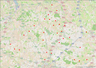
Communautés de papillons en paysage agricole (Ille et Vilaine, 2013-2014) Zone Atelier Armorique ZAAr: Objectif : Étude de l’effet de l’hétérogénéité de la mosaïque des cultures sur les communautés de papillons Protocole : Inventaire le long d’un transect en bordure et au centre de parcelles agricoles Article de référence : Sirami, C., Gross, N., Baillod, A. B., Bertrand, C., Carrié, R., Hass, A., ... & Fahrig, L. (2019). Increasing crop heterogeneity enhances multitrophic diversity across agricultural regions. Proceedings of the National Academy of Sciences, 116(33), 16442-16447. Programme de Recherche : ERA-Net BiodivERsA, Farmland
-
Occupation du sol du site de Pleine-Fougères en 2021 (Zone Atelier Armorique) réalisée à partir de la photo-interprétation de données satellitaires Sentinel 2. Réalisation par sous-traitance KERMAP. Images satellites SENTINEL A1 de l’année 2021 (10 m): ● Image acquise en avril 2021 ● Image acquise en mai 2021 ● Image acquise en juin 2021 ● Image acquise en juillet 2021 ● Image acquise en août 2021 Projection : RGF93 / Lambert-93 (EPSG 2154) Format : ESRI Shapefile. Echelle d’utilisation de la cartographie : 1/7 500e (pour l’année 2021 comme 2020) et 1/2 000e pour les autres millésimes). Unité Minimale de Cartographie : 2 500 m² (pour toutes évolutions observées en 2020) et 20 m2 (lors de l’étude des autres millésimes). Code OS 11 Route goudronnée 12 Chemin non goudronnée 13 Surface bâtie 14 Voie ferrée 15 Espaces associés au réseau routier ou ferroviaire 2 Eau 3 Bois 4 Friche 5 Sol nu 61 Prairie 62 Parc d’élevage (peu probable) 7 Maïs 8 Céréales 9 Autres cultures 700 Bande enherbée Nom du Champ Contenu Type Longueur OS_2021 Code de l’occupation du sol 2021 Nombre entier 10 LIB_2021 Libellé associé au code OS_2021 Texte 51 DOUTE Doute photo-interprète Texte 10 Commentair Commentaires photo-interprète Texte 250 AREA Surface en m² Numérique réel double 12 ; 6
-
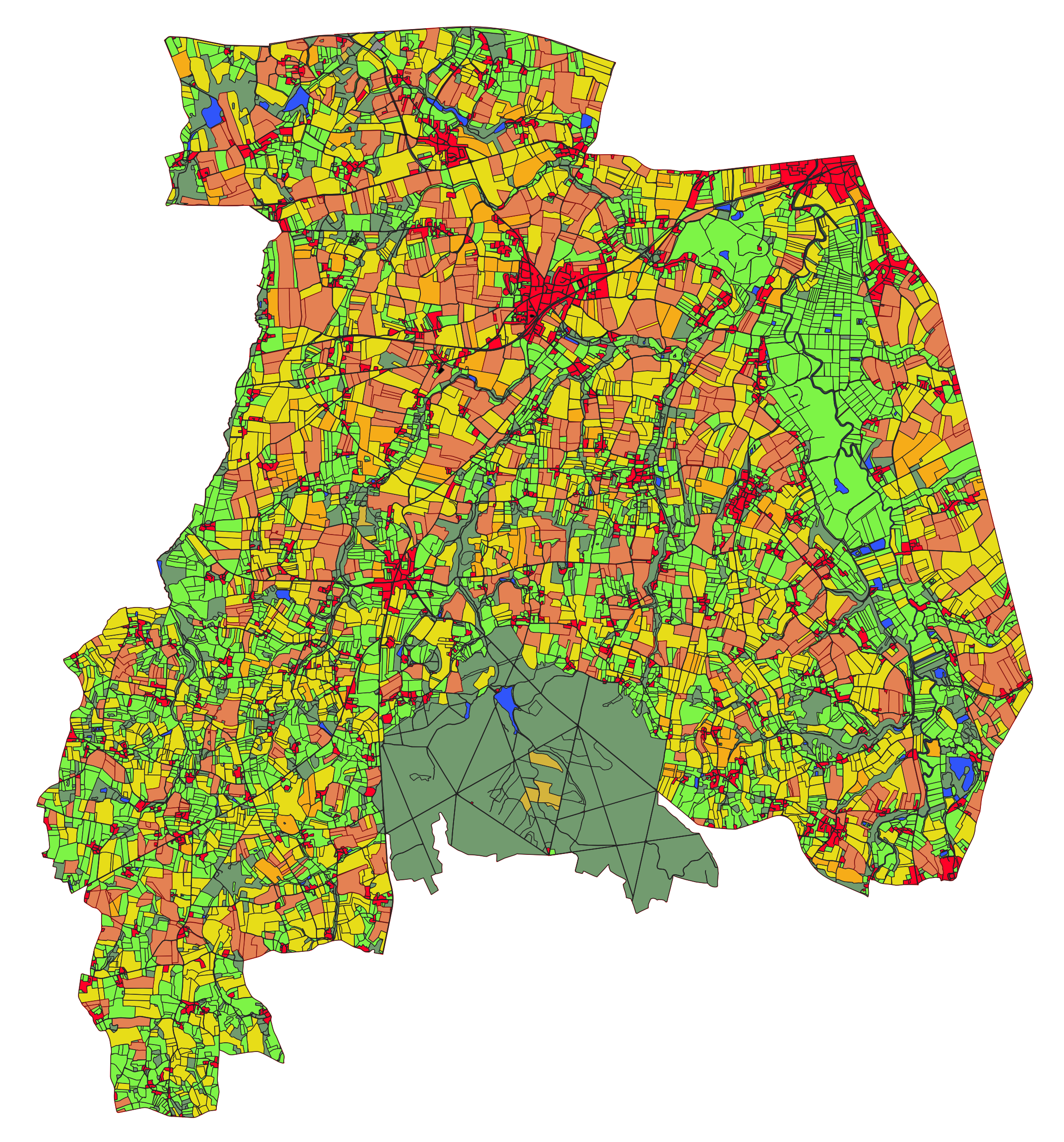
Occupation du sol du site de Pleine-Fougères en 2023 (Zone Atelier Armorique) Données source : - Occupation du sol 2022 - BD Ortho IGN 2023 - données OSO 2023 (CESBIO, Theia) Méthodologie : - Mise à jour du parcellaire par photo-interprétation de données aériennes (BD Ortho 2023). - Maintien des codes OS 2, 3, 11, 12, 13, 14, 15, 700 - remontée des données OSO majoritaires dans le parcellaire - conversion des valeurs selon le code suivant : 1: 13, # bâtis denses -> Surface bâtie 2: 13, # bâtis diffus -> Surface bâtie 3: 15, # zones ind et com -> Espaces associés au réseau routier ou ferroviaire 4: 11, # surfaces routes -> Route goudronnée 5: 9, # colza -> Autres cultures 6: 8, # céréales à pailles -> Céréales 7: 9, # protéagineux -> Autres cultures 8: 9, # soja -> Autres cultures 9: 9, # tournesol -> Autres cultures 10: 7, # maïs -> Maïs 11: 9, # riz -> Autres cultures 12: 9, # tubercules/racines -> Autres cultures 13: 61, # prairies (62 si OS_2022 == 62) 14: 9, # vergers -> Autres cultures 15: 9, # vignes -> Autres cultures 16: 3, # forêts de feuillus -> Bois 17: 3, # forêts de conifères -> Bois 18: 4, # pelouses -> Friche 19: 4, # landes ligneuses -> Friche 20: 5, # surfaces minérales -> Sol nu 23: 2 # eau -> Eau Projection : RGF93 / Lambert-93 (EPSG 2154) Format : ESRI Shapefile. Echelle d’utilisation de la cartographie : 1/7 500e (années 2020-2023) et 1/2 000e pour les autres millésimes). Code OS 11 Route goudronnée 12 Chemin non goudronné 13 Surface bâtie 14 Voie ferrée 15 Espaces associés au réseau routier ou ferroviaire 2 Eau 3 Bois 4 Friche 5 Sol nu 61 Prairie 62 Parc d’élevage (peu probable) 7 Maïs 8 Céréales 9 Autres cultures 700 Bande enherbée Nom du Champ Contenu Type Longueur OS_2023 Code de l’occupation du sol 2023 Nombre entier 10 LIB_2023 Libellé associé au code OS_2023 Texte 51 AREA Surface en m² Numérique réel double 12 ; 6
-
Occupation du sol du site de Pleine-Fougères en 2017 (Zone Atelier Armorique) réalisée à partir de la photo-interprétation de données satellitaires Pléiades. Réalisation par sous-traitance KERMAP. Cartographie réalisée par Photo-interprétation de photos ULM et d'images satellites PLEIADES de l’année 2017 Projection : RGF93 / Lambert-93 (EPSG 2154) Format : ESRI Shapefile. Echelle d’utilisation de la cartographie : 1/7 500e (pour l’année 2021 comme 2020) et 1/2 000e pour les autres millésimes). Unité Minimale de Cartographie : 2 500 m² (pour toutes évolutions observées en 2020) et 20 m2 (lors de l’étude des autres millésimes). Code OS 11 Route goudronnée 12 Chemin non goudronnée 13 Surface bâtie 14 Voie ferrée 15 Espaces associés au réseau routier ou ferroviaire 2 Eau 3 Bois 4 Friche 5 Sol nu 61 Prairie 62 Parc d’élevage (peu probable) 7 Maïs 8 Céréales 9 Autres cultures 700 Bande enherbée Nom du Champ Contenu Type Longueur OS_2021 Code de l’occupation du sol 2021 Nombre entier 10 LIB_2021 Libellé associé au code OS_2021 Texte 51 DOUTE Doute photo-interprète Texte 10 Commentair Commentaires photo-interprète Texte 250 AREA Surface en m² Numérique réel double 12 ; 6
-
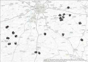
!! A mettre à jour !! (Accès dataset et carto) "Relevés de carabes en cultures annuelles en agriculture biologique et conventionnelle (sud Ille et Vilaine) - ZAAr" Objectif : étudier la diversité spécifique et l'activité-densité des prédateurs (carabes) au sein de parcelles de céréales d'hiver en agriculture biologique et conventionnelle, réparties dans 20 paysages au sud de l'Ille et Vilaine. Protocole : - échantillonnage des espèces et de leurs abondances (ou activités-densités) dans les parcelles, avec 4 stations de piégeage par parcelle (2 pots par station); pièges ouverts pendant 4 jours à 2 périodes (mai et juin). Suivis réalisés en 2014, 2015, 2016, 2018, 2021 et 2023 Programme de financement : projet SEBIOPAG-ECOPHYTO; SEBIOPAG-STAR; PREPARE; STABIREG http://sebiopag.inrae.fr/