biota
GEMET keywords
Type of resources
Available actions
Topics
INSPIRE themes
Keywords
Contact for the resource
Provided by
Years
Formats
Representation types
Update frequencies
status
Scale
Resolution
-
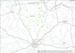
"Relevés floristiques en bordures de champs suivant un référentiel de 31 espèces dans 9 paysages agricoles distribués le long du fleuve Sélune, 2016" Relevés floristiques suivant un référentiel de 31 espèces (espèces du référentiel Ecobordure) sur une vingtaine de bordures de champs dans 9 paysages agricoles de 1km² distribués le long du fleuve Sélune. Projet de recherche: Seripage Site du projet de recherche: https://www6.rennes.inrae.fr/bagap/RECHERCHE/Analyse-et-modelisation-du-paysage/Projets-termines/SERIPAGE
-
Classification obtenue à partir d'une image LANDSAT datée du 25-05-2014 dans le cadre du projet SERIPAGE
-
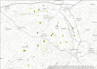
"Relevés de la structure des bordures des champs sur les 3 mini-réseaux (A, B et C) de la ZAAr, 2015" Relevés de la structure des bordures de champs sur les 3 mini-réseaux (site A, B et C) de la Zone Atelier Armorique. Les variables mesurées sont la largeur de la bordure, la longueur de la bordure, la présence ou non de talus, la hauteur de talus, la présence ou non de fossé, la profondeur du fossé, la présence ou non de clôture, la localisation de la clôture. En parallèle, sur un échantillon de bordure, c'est-à-dire sur un tronçon de 25m de long représentatif de la physionomie générale de la bordure: 1) caractérisation de la structure verticale de la bordure: observation de la présence ou non de strate arbustive (si oui, évaluation en % de l'échantillon de bordure), présence ou non de strate arborée (si oui, évaluation en % de la longueur de l'échantillon de bordure + mesure de la hauteur dominante de la canopée + mesure de la largeur de la canopée), 2) notation des espèces arbustives dominantes, notation des espèces arborées dominantes, 3) estimation du % sol nu, du % de litière, du % de rocher sur la longueur de l'échantillon de bordure. Valorisation: Alignier A. (2018) Changes in a field margin vegetation metacommunity over a 21-year interval and the impacts of structural condition and management. Agriculture, Ecosystems and Environment, 251, 1-10
-

Caractérisation de la diversité gamma des plantes du nord de l’ille et vilaine (2011): Effet de l’hétérogénéité paysagère sur la diversité gamma : le cas de la végétation. 20 mailles paysagères ont été choisies. Pour chaque maille : 5 habitats échantillonnés : les bois, les prairies permanentes, les prairies temporaires, les cultures et les haies. Pour mesurer la diversité gamma, 2 réplicats de chaque habitat ont été choisis : 10 relevés par maille. Pour chaque habitat 3 quadrats sont effectués Pour les prairies et les cultures, les quadrats sont de 2m*2m positionnés à 2, 6, et 10m de la bordure (Q1, Q2, Q3 respectivement). Pour les bois, les quadrats sont de 5m*5m et séparés d’une distance de 5m (de la bordure vers le centre : Q1, Q2, Q3). Les haies sont échantillonnées par 3 quadrats de 5m*2m séparés de 5m chacun. Les relevés ont été réalisés entre Mai et Aout 2011 Programme : Agriconnect (programme DIVA du ministère de l'environnement) Article de réf : Duflot R, Georges R, Ernoult A, Aviron S, Burel F. (2014) Landscape heterogeneity
-

Conséquences de l’intensification agricole sur l’abondance de deux rapaces diurnes : la buse variable (Buteo buteo) et le faucon crécerelle (Falco tinnunculus) (Depuis 2004): Suivi par méthode IPA et IKA de l’abondance de deux espèces de rapaces diurnes dans 3 contextes paysagers contrastés ZAA et polders de la Baie du Mont st Michel Suivi IPA-IKA permanent tous les deux mois depuis décembre 2004 (suivi mensuel au cours de l’année 2005) Article de référence : -Butet, A., Michel, N., Rantier Y., Comor, V., Hubert-Moy, L., Nabucet, J., Delettre, Y. 2010. Responses of Common Buzzard (Buteo buteo) and Eurasian Kestrel (Falco tinnunculus) to land use changes in agricultural landscapes of Western France. Agriculture, Ecosystems and Environment, 138: 152-159. Programme : Programme national ANR-ECCO (CNRS INSU) « Dynamique des paysages et interactions proies-prédateurs (petits mammifères, rapaces). Conséquences de l’intensification agricole sur l’architecture des réseaux trophiques et les transferts de biomasse.
-

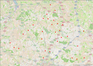
Comprendre la réponse des communautés végétales à la connectivité du paysage. 25 bois échantillonnés : La caractérisation des communautés végétales des bois a été faite à partir de relevés réalisés dans six quadrats de 14mx5m, selon un échantillonnage systématique dans chaque bois afin de prendre en compte leur éventuelle hétérogénéité. Trois sont placés le long de la lisière et trois en cœur, afin de mettre en évidence un éventuel « effet lisière ». La lisière a été définie à partir des premiers arbres (DBH>10 cm) et le cœur est la zone centrale du bois, à partir de 25m à la lisière, les principaux effets de lisière s’opérant dans les 20 premiers mètres à la bordure. La forme allongée des quadrats permet de prendre en compte l’hétérogénéité le long des lisières. L’échantillonnage couvre donc une surface de 210m2 en lisière et en cœur et 420m2 dans tout le bois, ce qui est en accord avec l’aire minimale requise pour caractériser les communautés végétales forestières (100 à 400 m2). Les pourcentages de recouvrement des plantes herbacées, arbustives et des arbres (canopée) ont été relevés dans chaque quadrat. Compte-tenu de l’emploi du temps, un seul passage a été effectué, à la fin du mois de juin afin d’augmenter les chances de capter à la fois les espèces précoces et les espèces tardives. Les relevés ont été réalisés en Juin 2012 Projet Agriconnect (2011-2015) : Continuités écologiques dans les paysages agricoles. Projet financé par le ministère chargé de l’écologie dans le cadre du programme DIVA.
-

Communautés de papillons en paysage agricole (Ille et Vilaine, 2013-2014) Zone Atelier Armorique ZAAr: Objectif : Étude de l’effet de l’hétérogénéité de la mosaïque des cultures sur les communautés de papillons Protocole : Inventaire le long d’un transect en bordure et au centre de parcelles agricoles Article de référence : Sirami, C., Gross, N., Baillod, A. B., Bertrand, C., Carrié, R., Hass, A., ... & Fahrig, L. (2019). Increasing crop heterogeneity enhances multitrophic diversity across agricultural regions. Proceedings of the National Academy of Sciences, 116(33), 16442-16447. Programme de Recherche : ERA-Net BiodivERsA, Farmland
-
Objectif : Etude de l’effet de l’hétérogénéité de la mosaïque des cultures sur le service écosystémique de pollinisation Protocole : Dépôt de plants de radis en fleurs en bordure de parcelle, laissés libres à la pollinisation ou non, puis récolte et pesage des graines Article de référence : Landscape configurational heterogeneity by small-scale agriculture, not crop diversity, maintains pollinators and plant reproduction in Western Europe, Annika L. Hass, Urs G. Kormann, Teja Tscharntke, Yann Clough, Aliette Bosem Baillod, Clélia Sirami, Lenore Fahrig, Jean-Louis Martin, Jacques Baudry, Colette Bertrand, Jordi Bosch, Lluís Brotons, Françoise Burel, Romain Georges, David Giralt, María Á. Marcos-García, Antonio Ricarte, Gavin Siriwardena and Péter Batáry. Proceedings of the Royal Society London B, 14 février 2018. DOI : 10.1098/rspb.2017.2242 Programme de Recherche : ERA-Net BiodivERsA, Farmland
-
Objectif : Cette opération consiste à suivre les effectifs de cette espèce au cours du temps et de lier la dynamique observée avec les actions menées. Programme de recherche : Convention d'étude avec la communauté des communes de la baie du Mont St-Michel Coordinatrice : Cendrine Mony
-
Le jeu de données comprend la vitesse de décomposition en milieux aquatique, terrestre humide et terrestre sec dans la forêt de Villecartier pour 18 espèces d'arbres (..........................................). Les caractéristiques chimiques (composition élémentaire C,N,P; teneur en phénol/polyphénol, cellulose, hémicellulose, métaboliques secondaires, terpènes, micronutriments) ainsi que leurs caractéristiques physiques (dureté, épaisseur, SLA, capacités de retention en eau) ont également été mesurées. De plus, la colonisation par les invertébrés et la biomasse microbienne (par mesure de respiration par la méthode SIR) ont été mesurées dans chaque milieux et pour chaque type de feuille. Des données sur les communautés d'invertébrés et les conditions climatiques (température, hygrométrie) des sites sont également disponibles
 OSURIS