 OSURIS
inlandWaters
GEMET keywords
Type of resources
Available actions
Topics
INSPIRE themes
Keywords
Contact for the resource
Provided by
Years
Formats
Representation types
Update frequencies
status
Scale
Resolution
-
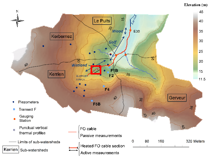
Data corresponding to the active-DTS experiment conducted in Kerrien by deploying and burying an heatable FO cable in the streambed sediments (in the wetland area). Further details are available in the file: http://agrhys.fr/BVE/nataline/mesuresactives/infos.pdf and results are presented in Simon et al. (2021)
-
Étude sur les zones humides de la "Baie du Mont Saint Michel". Cartographie linéaire des résaux hydrographiques. Site Étudié : Marais d'Aucey-Boucey. Objectif : -Diagnostics phyto-écologique et paysager des marais de la basse vallée du Couesnon et de leur rôle fonctionnel potentiel en terme d'accueil de l'avifaune. -Proposer des orientations de gestion. -Optimiser les conditions d'accueil pour l'avifaune, par une gestion intégrée des activités humaines sur les sites concernés. -Identifier les enjeux de conservation.
-
Étude sur les zones humides de la "Baie du Mont Saint Michel". Site Étudié : Marais du Couesnon. Objectif : -Diagnostics phyto-écologique et paysager des marais de la basse vallée du Couesnon et de leur rôle fonctionnel potentiel en terme d'accueil de l'avifaune. -Proposer des orientations de gestion. -Optimiser les conditions d'accueil pour l'avifaune, par une gestion intégrée des activités humaines sur les sites concernés. -Identifier les enjeux de conservation.
-
Étude sur les zones humides de la "Baie du Mont Saint Michel". Cartographie de l'occupation du sol. Site Étudié : Marais du Couesnon. Objectif : -Diagnostics phyto-écologique et paysager des marais de la basse vallée du Couesnon et de leur rôle fonctionnel potentiel en terme d'accueil de l'avifaune. -Proposer des orientations de gestion. -Optimiser les conditions d'accueil pour l'avifaune, par une gestion intégrée des activités humaines sur les sites concernés. -Identifier les enjeux de conservation.
-
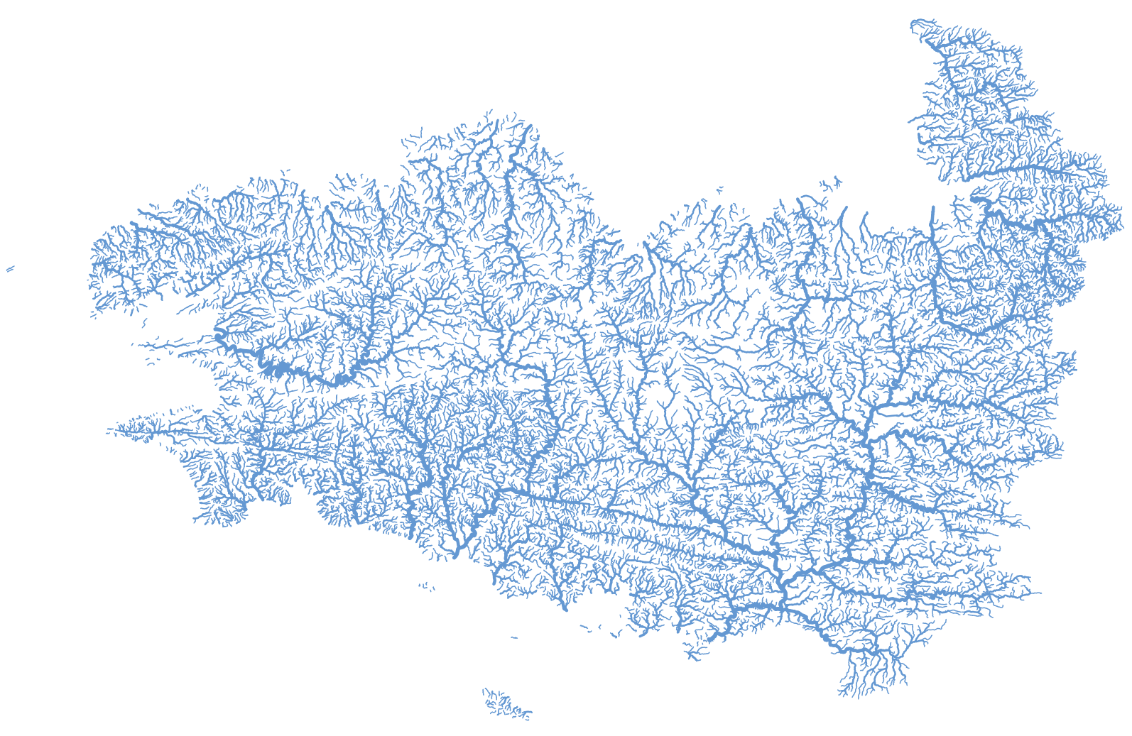
Représentation des tronçons hydrographiques de la Bretagne et des bassins versants de la baie du Mont Saint-Michel extraite de la BD Topage® version 2020. cette couche géographique est corrigée de telle sorte que soit garantie l'unicité du chemin de l'eau de l'amont vers l'aval (suppression des boucles, des canaux, ...).
-
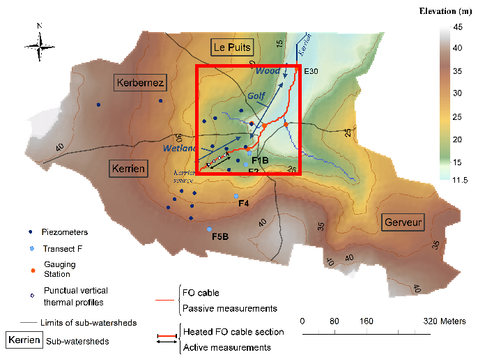
Data corresponds to the long-term monitoring of streambed sediments conducted in Kerbernez through Fiber Optic (FO) DTS technology. The streambed temperature is continuously monitored at high resolution all along the FO cable in order to highlight and quantify groundwater/stream exchanges. Further details are available in the file: http://agrhys.fr/BVE/nataline/mesurespassives/infos.pdf and results are presented in Simon et al. (2021)
-
Étude sur les zones humides de la "Baie du Mont Saint Michel". Site Étudié : Marais du Mesnil. Objectif : -Diagnostics phyto-écologique et paysager des marais de la basse vallée du Couesnon et de leur rôle fonctionnel potentiel en terme d'accueil de l'avifaune. -Proposer des orientations de gestion. -Optimiser les conditions d'accueil pour l'avifaune, par une gestion intégrée des activités humaines sur les sites concernés. -Identifier les enjeux de conservation.
-
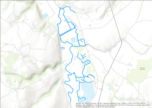
Étude sur les zones humides de la "Baie du Mont Saint Michel". Cartographie linéaire des résaux hydrographiques. Site Étudié : Marais du Couesnon. Objectif : -Diagnostics phyto-écologique et paysager des marais de la basse vallée du Couesnon et de leur rôle fonctionnel potentiel en terme d'accueil de l'avifaune. -Proposer des orientations de gestion. -Optimiser les conditions d'accueil pour l'avifaune, par une gestion intégrée des activités humaines sur les sites concernés. -Identifier les enjeux de conservation.
-
Étude sur les zones humides de la "Baie du Mont Saint Michel". Cartographie linéaire des résaux bocagers. Site Étudié : Marais de la Folie. Objectif : -Diagnostics phyto-écologique et paysager des marais de la basse vallée du Couesnon et de leur rôle fonctionnel potentiel en terme d'accueil de l'avifaune. -Proposer des orientations de gestion. -Optimiser les conditions d'accueil pour l'avifaune, par une gestion intégrée des activités humaines sur les sites concernés. -Identifier les enjeux de conservation.
-
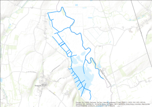
Étude sur les zones humides de la "Baie du Mont Saint Michel". Cartographie linéaire des résaux hydrographiques. Site Étudié : Marais de Sougéal Communal. Objectif : -Diagnostics phyto-écologique et paysager des marais de la basse vallée du Couesnon et de leur rôle fonctionnel potentiel en terme d'accueil de l'avifaune. -Proposer des orientations de gestion. -Optimiser les conditions d'accueil pour l'avifaune, par une gestion intégrée des activités humaines sur les sites concernés. -Identifier les enjeux de conservation.