 OSURIS
France
GEMET keywords
Type of resources
Available actions
Topics
INSPIRE themes
Keywords
Contact for the resource
Provided by
Years
Formats
Representation types
Update frequencies
status
Service types
Scale
Resolution
-
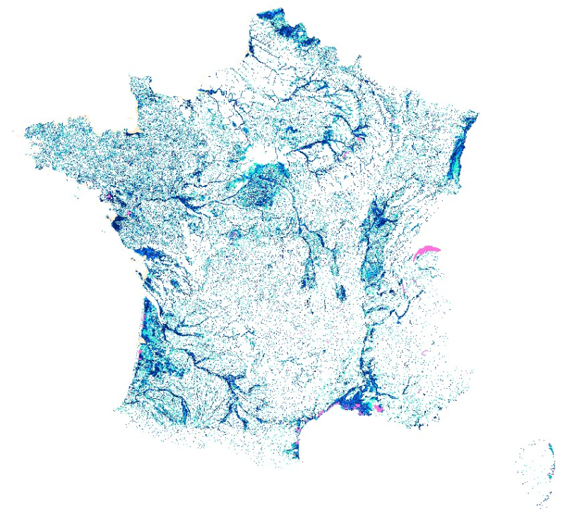
Enveloppes de milieux potentiellement humides en 3 classes de confiance. La prédiction des zones humides est un enjeu majeur pour concevoir et mettre en œuvre une politique nationale cohérente visant à la préservation de ces écosystèmes fragiles mais essentiels qui sont impliqués dans la production de nombreux services écosystémiques. Fortement liée à la situation topographique, l’occurrence des zones humides potentielles est principalement conditionnée par la géomorphologie, les précipitations et la dénivelée au cours d’eau. Cette étude teste à l’échelle de la France métropolitaine le développement et la mise en œuvre d’une méthode fondée sur la combinaison d’un indice topo-climatique (Mérot et al., 2003) avec la dénivelée au cours d’eau pour prédire la distribution spatiale des zones humides potentielles. Pour plus d'informations, consulter la notice accompagnement : https://geosas.fr/metadata/pdf/Notice_MPH_France-1.pdf
-
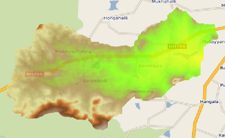
This raster map is the Digital Elevation Model of the Berambadi watershed
-
La couche station représente la position géographique des stations sur lesquelles peuvent être effectuées des mesures de déformation (gravimétrie, inclinométrie), des mesures liées au site (données météo, données de rivière) ou bien des mesures d'écoulement dans le cas où la station se trouve sous terre. Ce sont des chroniques (données météo), des mesures ponctuelles ou bien des mesures issues d'expériences.
-
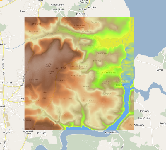
Modèle Numérique de Terrain (MNT) à 5 mètres de résolution calculé par rééchantillonage basé sur la méthode de la médiane de la donnée Litto3D à 1 mètre de résolution. L'emprise géographique du MNT contient l'ensemble du site de l'Observatoire de Recherche en Environnement (ORE) AgrHyS de Kerbernez à Plomelin dans le Finistère.
-
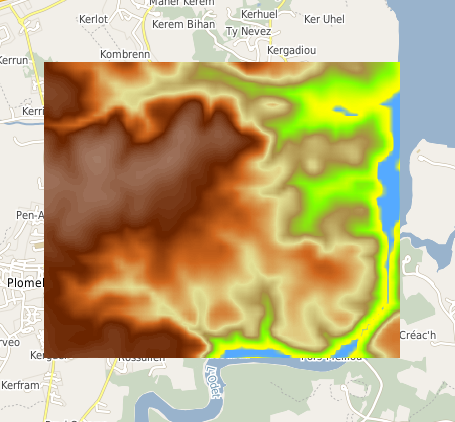
Modèle Numérique de Terrain (MNT) à 10 mètres de résolution calculé par interpolation bilinéaire de la BD ALTI Version 2.0 de l'IGN à 25 mètres de résolution. L'emprise géographique du MNT correspond au site de l'Observatoire de Recherche en Environnement (ORE) AgrHyS de Kerbernez sur la commune de Plomelin dans le Finistère.
-
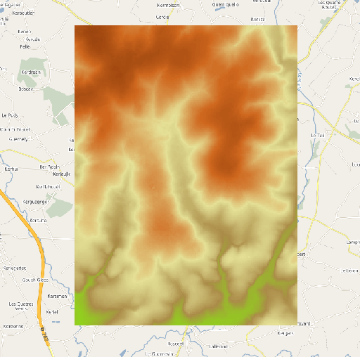
Modèle Numérique de Terrain (MNT) à 25 mètres de résolution extrait de la BD ALTI Version 2.0 de l'IGN à 25 mètres de résolution. L'emprise géographique du MNT correspond au site de l'Observatoire de Recherche en Environnement (ORE) AgrHyS de Naizin dans le Morbihan.
-
La couche puits represente la position geographique des puits sur lesquels sont effectuées des mesures chimiques, in situ (geophysique, imagerie ...), hydrauliques. Ce sont des chroniques ou bien des mesures issues d'expériences (dilution, essai de pompage ...)
-
En quelques mots : Le projet Biomonitoring "Effet des arasements sur les communautés animales et végétales de la Sélune" a pour principal objectif de réaliser un état de référence de la qualité biologique de la Sélune à l’amont et à l’aval des deux barrages ainsi que dans les retenues. Il vise également à identifier les risques (exposition aigüe) pendant les travaux de fixation des boues contaminées de l’Yvrande. Objectifs Répondre aux questions : Comment l'écosystème lotique se restaure-t-il après disparition d'un lac de barrage, et quels nouveaux équilibres écologiques en résultent ? Quels seront les effets des travaux d'arasement sur la qualité des milieux et leurs conséquences sur les biocénoses qui s'y développent ? Méthodes : IBMR ; IBGN ; IBD ; suivi des biofilms ; caractérisation physico-chimique Données : - Suivi des conditions physico-chimiques (t°c, conductivité, pH...) - Concentration en nitrates, silicates, azote et phosphore total - Suivi des communautés d’invertébrés - Suivi des communautés de phyto- et zoo-plancton, et mesure de la biomasse de phytoplancton - Suivi du biofilm (2015 à 2017) - Suivi des plantes aquatiques (1996) - Relevés floristique des plantes aquatiques (2015, 2017) - Caractérisation toxicologique des poissons de la retenue de Vezins - Analyse des contenus stomacaux (GCA) des poissons
-
En quelques mots : La vidange des deux retenues associés aux barrages de la Sélune va provoquer une modification des flux de sédiments et de substances organiques ou minérales jusque-là piégés dans les retenues en aval des barrages. Cette modification pourrait affecter les biocœnoses bentho-démersales situées plus en aval, au contact de la baie du Mont Saint Michel, dans la zone dite « petite baie ». Objectifs effectuer un état initial (pré-vidange) des communautés benthiques et bentho-démersales des estuaires de la Sélune et de la Sée (témoin), caractériser la variabilité saisonnière de ces deux communautés en termes de composition et d’assemblage, intégrer une approche fonctionnelle de l’estuaire en incluant le dynamisme trophique via l’analyse des contenus stomacaux des espèces ichtyologiques et la détermination de l’ensemble des sources trophiques par la technique d’analyses isotopiques Données prélèvements d'invertébrés macrobenthiques et d'icthyofaune analyses isotopiques analyse des contenus stomacaux (GCA) des poissons mesure de paramètres physico-chimiques et analyse de la granulométrie
-
Le service d’observation H+ a été créé en 2002, avec trois missions principales : La mission première de l’observatoire H+ est de maintenir et de coordonner un réseau de sites expérimentaux capables de fournir des données pertinentes – y compris des chroniques ou expériences long terme – pour la compréhension du cycle de l’eau et des éléments transportés dans les aquifères. Le couplage mesures / théories / modèles est une mission fondamentale de l’observatoire H+. La modélisation, à quelque niveau qu’elle soit, est un outil indispensable à la prédiction. L’observatoire a pour vocation de créer un lien pérenne entre les équipes de recherche intéressées par les aspects théoriques, numériques ou expérimentaux des transferts en milieu hétérogène. L’observatoire H+ a enfin pour mission d’établir un partenariat entre la recherche fondamentale, la formation initiale et continue, et l’expertise : bureaux d’études, régie de l’eau, ... Les sites de H+ accueillent des étudiants et des professionnels dans le cadre de formations sur l’exploitation de la ressource et la prévention des risques environnementaux. La base de données contient toutes les mesures effectuées sur les différents sites, chroniques, expériences, mesures de géophysiques et données spatialisées.